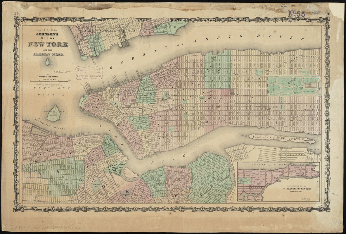
Johnson's map of New York and the adjacent cities
Item Information
- Title:
- Johnson's map of New York and the adjacent cities
- Title (alt.):
-
Map of New York and the adjacent cities
- Creator:
- Johnson and Ward
- Name on Item:
-
by Johnson and Ward.
- Date:
-
[1864?]
- Format:
-
Maps/Atlases
- Location:
-
Boston Public Library
Norman B. Leventhal Map & Education Center - Collection (local):
-
Norman B. Leventhal Map & Education Center Collection
- Subjects:
-
Military bases--New York (State)--New York--Maps
Ferry routes--New York (State)--New York--Maps
Streets--New York (State)--New York--Maps
New York (N.Y.)--Maps
Manhattan (New York, N.Y.)--Maps
- Places:
-
New YorkNew YorkManhattan
- Extent:
- 1 map : col. ; 39 x 62 cm.
- Terms of Use:
-
No known copyright restrictions.
No known restrictions on use.
- Publisher:
-
[New York] :
Johnson and Ward
- Scale:
-
Scale [ca. 1:20,500]
- Language:
-
English
- Notes:
-
Shows street names, wards, railroads, military installations, ferry routes, parks, and some buildings for New York City and parts of Brooklyn, Jersey City, and Hoboken. Also shows names of buildings on Blackwells Island.
Inset: Continuation of the City & County of New York on a reduced scale.
On right upper margin: 30.
On left upper margin: 29.
Verso: Geographical index, or ready reference, p. 37-38.
From Johnson's new illustrated (steel plate) family atlas.
- Identifier:
-
06_01_010807
- Call #:
-
G3804.N4 1864 .J64
- Barcode:
-
39999065677039


