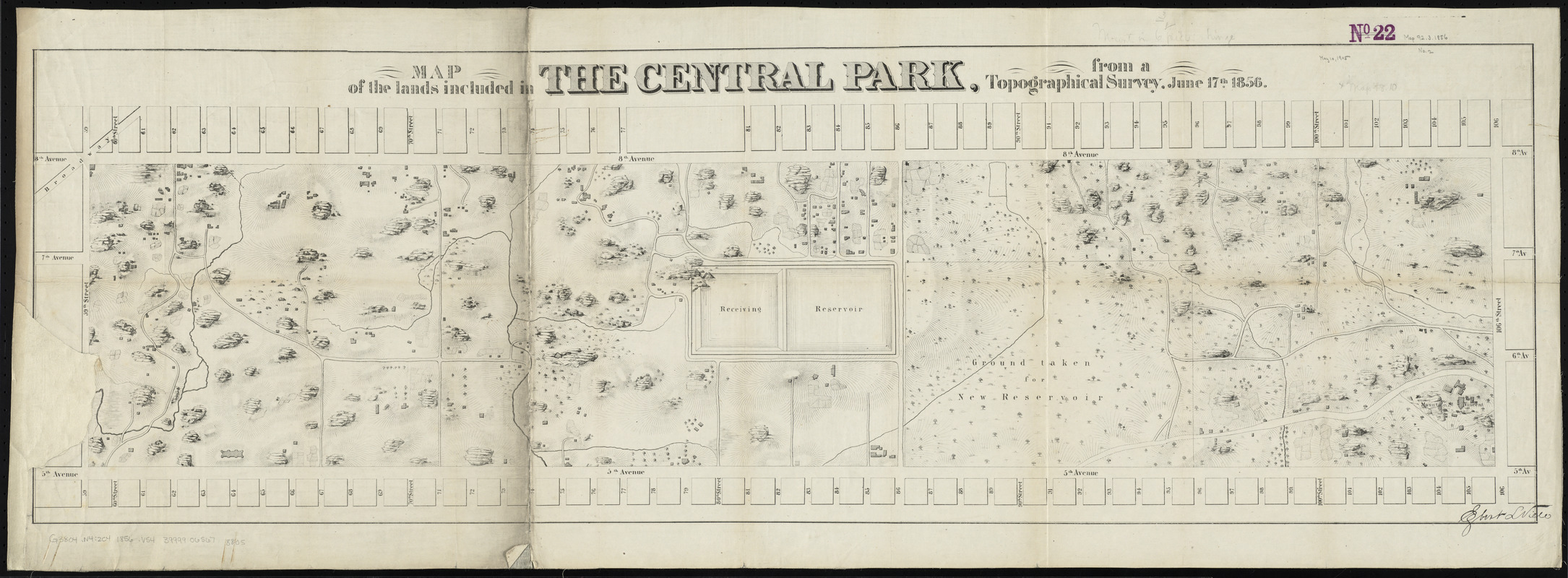
Map of the lands included in the Central Park, from a topographical survey, June 17th, 1856
Item Information
- Title:
- Map of the lands included in the Central Park, from a topographical survey, June 17th, 1856
- Cartographer:
- Viele, Egbert L. (Egbert Ludovicus), 1825-1902
- Date:
-
[1856]
- Format:
-
Maps/Atlases
- Location:
-
Boston Public Library
Norman B. Leventhal Map & Education Center - Collection (local):
-
Norman B. Leventhal Map & Education Center Collection
- Subjects:
-
Central Park (New York, N.Y.)--Planning--Maps
New York (N.Y.)--Maps
- Places:
-
New YorkNew YorkManhattanCentral Park
- Extent:
- 1 map ; 36 x 114 cm
- Terms of Use:
-
No known copyright restrictions.
No known restrictions on use.
- Publisher:
-
New York :
Ferd. Mayer & Co.
- Scale:
-
Scale approximately 1:3,700
- Language:
-
English
- Notes (date):
-
This date is inferred.
- Identifier:
-
06_01_010784
- Call #:
-
G3804.N4:2C4 1856 .V54
- Barcode:
-
39999065678805


