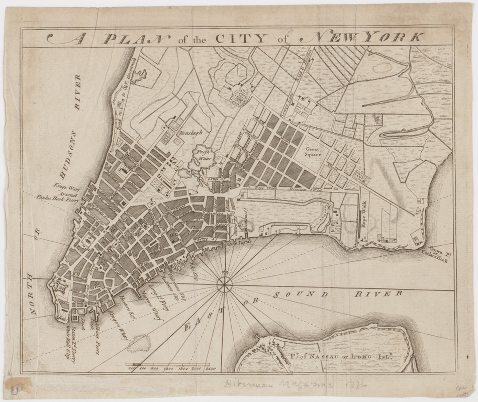
A Plan of the city of New York
This map is also available in American Revolutionary Geographies Online (ARGO), a collections portal especially built for material relating to the American Revolutionary War Era. Visit ARGO to learn more about this item and explore the historical geography of North America in the late eighteenth century.
Item Information
- Title:
- A Plan of the city of New York
- Title (uniform):
-
Hibernian magazine
- Description:
-
Subject: Map of the southern part of the island of Manhattan, New York.
- Date:
-
[1776]
- Format:
-
Maps/Atlases
- Location:
- American Antiquarian Society
- Collection (local):
-
American Antiquarian Society Collection
- Subjects:
-
New York (N.Y.)--Maps
- Places:
-
New York
- Extent:
- 1 map : engraving ; 18 x 22 cm., on sheet 20 x 24 cm.
- Terms of Use:
-
Public Domain/No known restrictions on use. Contact host institution to download image.
Contact host institution for more information.
- Publisher:
-
Dublin? :
[s.n.]
- Scale:
-
Scale indeterminable
- Language:
-
English
- Catalog Record:
-
http://catalog.mwa.org/vwebv/holdingsInfo?bibId=488636
- Notes:
-
Relief shown by hachures.
The American Antiquarian Society copy annotated in pencil: Hibernian magazine 1776.
- Notes (date):
-
This date is inferred.
![[Plan of New York]](https://bpldcassets.blob.core.windows.net/derivatives/images/commonwealth:6108vt38k/image_thumbnail_300.jpg)


