Search Constraints
Search Results


4502. Leodiensis dioecesis


4504. Leominster, Mass : 1886
![Leonard Chace (Owner), Old Colony Storage & Warehouse Co., Inc. (Lessee), Firestone Cotton Mills (Tenant), Fall River, Mass. [insurance map]](https://bpldcassets.blob.core.windows.net/derivatives/images/commonwealth:ww72bx46m/image_thumbnail_300.jpg)


4512. Lexington map 1794
![Library districts [in Boston]](https://bpldcassets.blob.core.windows.net/derivatives/images/commonwealth:3f465b625/image_thumbnail_300.jpg)


4515. Libyae interioris pars


4518. Lincoln County

4519. Lincoln County, Wis.


![The Linen Thread Co., Inc. "Gloucester Mill," Gloucester, Mass. [insurance map]](https://bpldcassets.blob.core.windows.net/derivatives/images/commonwealth:ww72bz006/image_thumbnail_300.jpg)

4523. Lines of Charleston


4529. Little Falls, N.Y : 1881


4532. Livermore Falls, Maine

4533. Liverpool
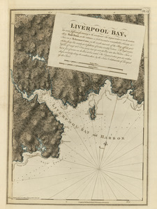
4534. Liverpool Bay

4535. Liverpool Bay


4554. Locality map


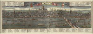
4560. London

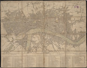
4561. London

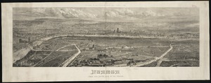
4562. London


4568. Long Island


4581. Longwood Medical Area
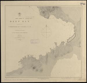
4583. Loo Choo Id., Deep Bay
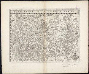
4587. Lorraine
![Lorraine Mfg. Co. (Cotton & Worsted Mill), Pawtucket, R.I. [insurance map]](https://bpldcassets.blob.core.windows.net/derivatives/images/commonwealth:2r36vc298/image_thumbnail_300.jpg)


4597. Louisiana


