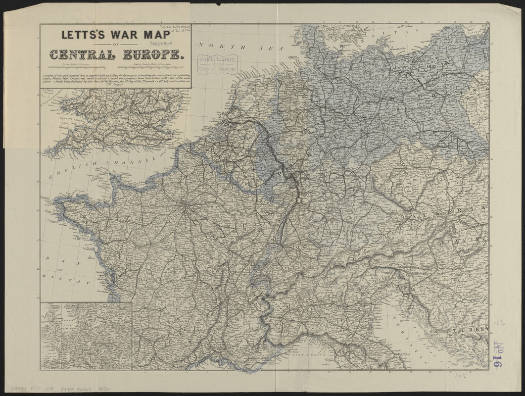
Letts's war map of Central Europe
Item Information
- Title:
- Letts's war map of Central Europe
- Title (alt.):
-
Letts's general map of the seat of war, in Central Europe, as described in July 1870
- Publisher:
- Letts, Son & Co.
- Date:
-
1870
- Format:
-
Maps/Atlases
- Location:
-
Boston Public Library
Norman B. Leventhal Map & Education Center - Collection (local):
-
Norman B. Leventhal Map & Education Center Collection
- Subjects:
-
Franco-Prussian War, 1870-1871--Maps
Europe--Maps
- Places:
-
Europe
Europe
- Extent:
- 1 map : color ; 48 x 62 cm, folded in cover 20 x 13 cm
- Terms of Use:
-
No known copyright restrictions.
No known restrictions on use.
- Publisher:
-
London :
Letts, Son & Co.
- Scale:
-
Scale approximately 1:2,816,000
- Language:
-
English
- Notes:
-
No. 1, France, Prussia, Belgium, Holland, Germany, Austria, Italy, &c.--cover.
This is a general political map, intended to be used by the user to indicate the progress of the war.
Inset: [Europe].
- Identifier:
-
06_01_014037
- Call #:
-
G5700 1870 .L48
- Barcode:
-
39999065698050


