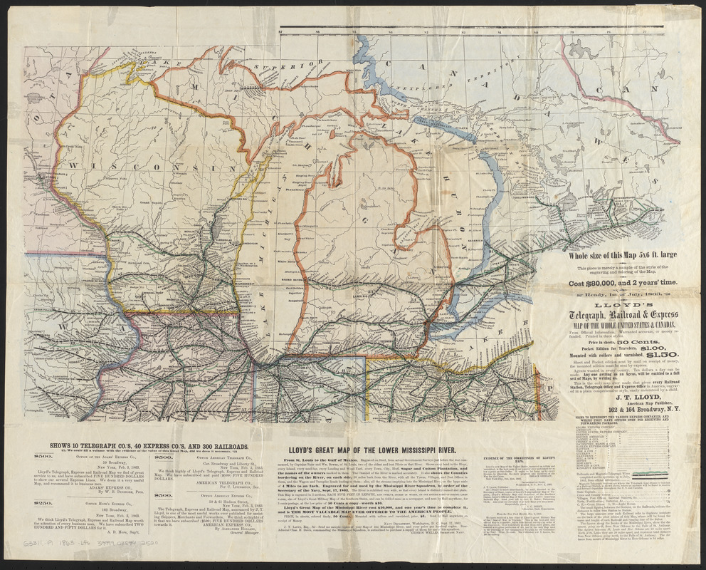
Lloyd's telegraph, railroad & express map of the whole United States & Canadas, from official information
Item Information
- Title:
- Lloyd's telegraph, railroad & express map of the whole United States & Canadas, from official information
- Title (alt.):
-
Lloyd's telegraph, railroad and express map of the whole United States and Canadas, from official information
- Description:
-
Promotional prospectus for Lloyd's railroad, telegraph & express map of the United States and Canadas, with endorsements and production information. Sample sheet of the map covering the Great Lakes area.
- Cartographer:
- Lloyd, James T.
- Date:
-
[1863]
- Format:
-
Maps/Atlases
- Location:
-
Boston Public Library
Norman B. Leventhal Map & Education Center - Collection (local):
-
Norman B. Leventhal Map & Education Center Collection
- Subjects:
-
Express service--Great Lakes Region (North America)--Maps
Railroads--Great Lakes Region (North America)--Maps
Telegraph lines--Great Lakes Region (North America)--Maps
Great Lakes Region (North America)--Maps
- Places:
-
Great Lakes Region (area)
- Extent:
- 1 map : color ; 35 x 59 cm, on sheet 49 x 62 cm
- Terms of Use:
-
No known copyright restrictions.
No known restrictions on use.
- Publisher:
-
New York :
J.T. Lloyd
- Scale:
-
Scale approximately 1:2,200,000
- Language:
-
English
- Notes:
-
Includes advertisements for other maps by the publisher.
- Notes (date):
-
This date is inferred.
- Identifier:
-
06_01_016072
- Call #:
-
G3311.P1 1863 .L46
- Barcode:
-
39999085942520