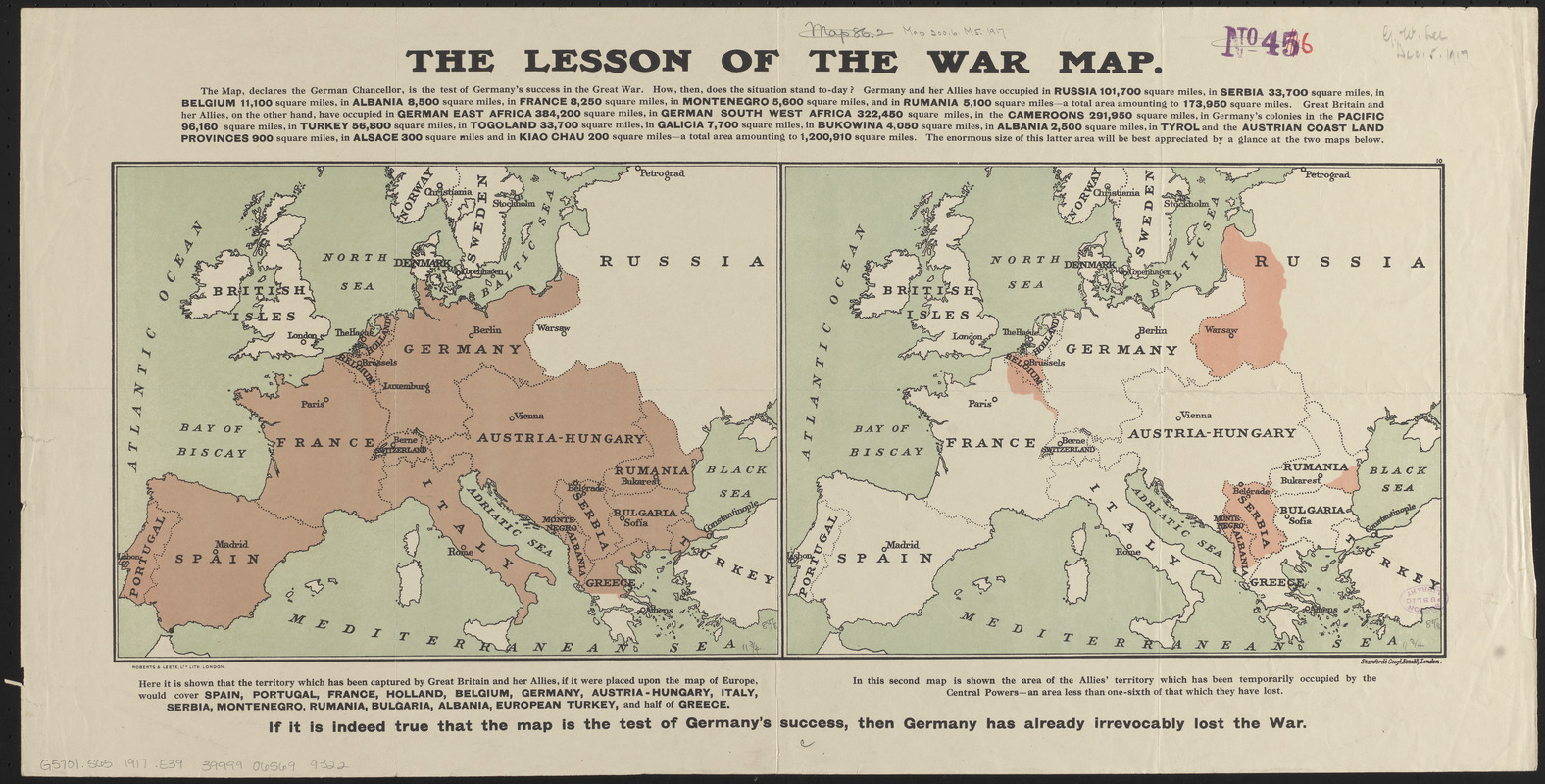
The lesson of the war map
Item Information
- Title:
- The lesson of the war map
- Publisher:
- Edward Stanford Ltd.
- Date:
-
[1917?]
- Format:
-
Maps/Atlases
- Location:
-
Boston Public Library
Norman B. Leventhal Map & Education Center - Collection (local):
-
Norman B. Leventhal Map & Education Center Collection
- Subjects:
-
World War, 1914-1918--Europe--Maps
World War, 1914-1918--Occupied territories--Maps
Europe--Maps
- Places:
-
Europe
Europe
- Extent:
- 2 maps on 1 sheet : color ; 22 x 30 cm, sheet 35 x 69 cm
- Terms of Use:
-
No known copyright restrictions.
No known restrictions on use.
- Publisher:
-
London :
Stanford's Geogl. Estabt.
- Scale:
-
Scale approximately 1:12,000,000
- Language:
-
English
- Table of Contents:
-
[Territory captured by Great Britain and her allies]
[Territory occupied by the Central Powers].
- Notes:
-
Compares the amount of territory occupied by the Allies versus that of the Central Powers.
In lower margin: If it is indeed true that the map is the test of Germany's success, then Germany has already irrevocably lost the war.
Includes additional text.
- Identifier:
-
06_01_014116
- Call #:
-
G5701.S65 1917 .E39
- Barcode:
-
39999065699322