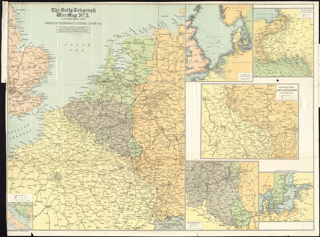
The Daily Telegraph war map no. 2
Item Information
- Title:
- The Daily Telegraph war map no. 2
- Title (uniform):
-
Daily telegraph (London, England)
- Creator:
- Gross, Alexander, 1879-1958
- Name on Item:
-
by Alexander Gross ; produced by "Geographia" Ltd.
- Date:
-
[1915]
- Format:
-
Maps/Atlases
- Location:
-
Boston Public Library
Norman B. Leventhal Map & Education Center - Collection (local):
-
Norman B. Leventhal Map & Education Center Collection
- Subjects:
-
World War, 1914-1918--Campaigns--Western Front--Maps
World War, 1914-1918--Campaigns--Europe--Maps
World War, 1914-1918--Europe--Maps
Europe--Maps
North Sea Region--Maps
- Places:
-
Europe
North Sea
Europe
- Extent:
- 1 map : color ; 73 x 99 cm, folded in cover 21 x 13 cm
- Terms of Use:
-
No known copyright restrictions.
No known restrictions on use.
- Publisher:
-
London :
"Geographia" Ltd.
- Scale:
-
Scale approximately 1:1,200,000
- Language:
-
English
- Table of Contents:
-
Daily Telegraph war map no. 2 [western European war area]
The Adriatic Sea
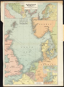
The North Sea and adjacent countries
Russian, German & Austrian frontiers
The district round Nancy and Strassburg
Liége & Namur District
The Baltic Sea and adjacent countries.
- Notes:
-
This large scale map is a supplement to the Daily Telegraph" war map of Europe no. 1 and should be used in conjunction with same."
Includes 1 inset and 5 ancillary maps.
- Notes (date):
-
This date is inferred.
- Identifier:
-
06_01_012041
- Call #:
-
G5701.S65 1915 .G76
- Barcode:
-
39999065692640