Toggle navigation
LMEC Home
Exhibitions
Georeferencing
Tools for Teachers
Collections
My Favorites
Sign Up / Log In
Search
Search the map portal
Map Collection
Map Collection
Map Sets
Search
Search
Search for
Search In
All Fields
Creator
Title
Subject
Place
Search All Digital Collections
Advanced Search
104 Results
My Search
Start Over
g3700
Remove constraint g3700
Filter your Search
Place
United States
93
North and Central America
17
Mexico
6
North America
6
West Indies
5
Mesoamerica
3
Canada
2
Louisiana
2
more
Place
»
Topic
United States--Maps
74
United States--Maps--Early works to 1800
15
Mexico--Maps
6
North America--Maps
6
Railroads--United States--Maps
6
West Indies--Maps
6
Advertising cards--Specimens
4
Advertising--Coffee
4
more
Topic
»
Date
Date range begin
–
Date range end
Current results range from
1707
to
1923
View distribution
Creator
Geological Survey (U.S.)
8
Arbuckle Bros.
4
Young, J. H. (James Hamilton)
4
Colton, G. Woolworth (George Woolworth), 1827-1901
3
Arrowsmith, Aaron, 1750-1823
2
Bradley, Abraham, 1767-1838
2
Brightly, Joseph H., 1818-1901
2
Chapin, William, 1802-1888
2
more
Creator
»
Format
Maps/Atlases
104
Manuscripts
2
Georeferenced
Yes
25
No
79
Collection
Norman B. Leventhal Map Center Collection
104
American Revolutionary War-Era Maps
14
Boston and New England Maps
4
Available to use
No known restrictions
104
Search Constraints
Sort by relevance
relevance
title
date (asc)
date (desc)
Number of results to display per page
20 per page
10
per page
20
per page
50
per page
100
per page
View results as:
grid view
map view
Search Results
1.
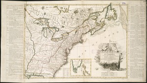
An accurate map of the United States of America, with part of the surrounding provinces agreeable to the Treaty of Peace of 1783
2.
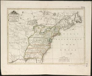
Alden's pictorial map of the United States of North America
3.
Amerikanisch-Spanischer kriegsschauplatz
4.
Amplissimae regionis Mississipi seu provinciae Ludovicianae â R.P. Ludovico Hennepin Francisc. Miss. in America septentrionali...
5.
Amplissimae regionis Mississipi seu Provinciae Ludovicianae â R.P. Ludovico Hennepin Francisc Miss in America Septentrionali...
6.
Base-map of the United States
7.
Bowles's new one-sheet map of the independent states of Virginia, Maryland, Delaware, Pensylvania, New Jersey, New York,...
8.
Carte de la Louisiane cours du Mississipi et pais voisins : dediée à M. le Comte de Maurepas, ministre et secretaire d'etat...
9.
Carte des Etats-Unis
10.
Carte des Etats-Unis de l'Amerique suivant le Traité de Paix de 1783
11.
Carte générale des États-Unis de l'Amérique avec les plans des principales villes
12.
Carte generale des treize Etats Unis, de l'Amerique septentrionale
13.
Case's map of the United States, the British provinces, Mexico, and part of the West Indies : compiled from the latest...
14.
Charte über die XIII Vereinigte Staaten von Nord-America
15.
Colton's general map of the United States : showing the railroad routes across the continent
16.
Colton's map of the United States of America, the British provinces, Mexico and the West Indies : showing the country from the...
17.
Connecticut
18.
The eagle map of the United States
19.
États Unis
20.
Fredonia or the United States of North-America : including also Cabotia, or the Canadian provinces; the Western Territory to...
‹ Prev
Next ›
1
2
3
4
5
6