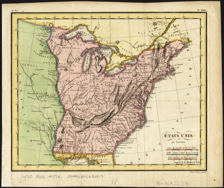
États Unis
Item Information
- Title:
- États Unis
- Creator:
- Arrowsmith, Aaron, 1750-1823
- Name on Item:
-
par Arrowsmith ; Semen Jeune sculp.
- Date:
-
[1803?]
- Format:
-
Maps/Atlases
- Location:
-
Boston Public Library
Norman B. Leventhal Map & Education Center - Collection (local):
-
Norman B. Leventhal Map & Education Center Collection
- Subjects:
-
United States--Maps
- Places:
-
United States
- Extent:
- 1 map : col. ; 19 x 24 cm.
- Terms of Use:
-
No known copyright restrictions.
No known restrictions on use.
- Publisher:
-
S.l :
s.n.
- Scale:
-
Scale ca. 1:11,500,000.
- Language:
-
French
- Notes:
-
Relief shown by hachures.
In upper margin: "G.35" and "P. XXIX."
Map of the United States showing the land west of the Mississippi River still as Louisiana. Ohio is named as a state. Many Indian tribes and villages are named. A lead mine is located in today's northwestern Illinois. Florida is divided into the Spanish possessions of East and West Florida, Georgia extends to the Mississippi.
- Identifier:
-
06_01_007534
- Call #:
-
G3700 1803 .A77x
- Barcode:
-
39999059033009


