Toggle navigation
LMEC Home
Exhibitions
Georeferencing
Tools for Teachers
Collections
My Favorites
Sign Up / Log In
Search
Search the map portal
Map Collection
Map Collection
Map Sets
Search
Search
Search for
Search In
All Fields
Creator
Title
Subject
Place
Search All Digital Collections
Advanced Search
31 Results
My Search
Start Over
help
Remove constraint help
Filter your Search
Place
North and Central America
18
United States
17
Boston
4
Massachusetts
4
Suffolk (county)
4
Atlantic Ocean
3
Essex (county)
2
Virginia
2
more
Place
»
Topic
Gulf Stream--Maps
3
Massachusetts--Maps
3
Atlases
2
United States--Maps
2
Adams Nervine Asylum
1
Asylums--Massachusetts--Boston--Maps
1
Ball's Bluff, Battle of, Va., 1861--Maps
1
Beaches--Massachusetts--Maps
1
more
Topic
»
Date
Date range begin
–
Date range end
Current results range from
1532
to
2019
View distribution
Creator
Amherst, Jeffery Amherst, Baron, 1717-1797
2
Brasier, William
2
Chase, Ernest Dudley, 1878-1966
2
Le Rouge, Georges-Louis.
2
Massachusetts. Department of Commerce and Development
2
Royal United Services Institute for Defence and Security Studies
2
Billingsley, James Andrew
1
Boston Landmarks Commission (Boston, Mass.)
1
more
Creator
»
Format
Maps/Atlases
26
Manuscripts
2
Photographs
2
Prints
2
Books
1
Drawings/Illustrations
1
Objects/Artifacts
1
Georeferenced
Yes
4
No
27
Collection
Norman B. Leventhal Map Center Collection
23
American Revolutionary War-Era Maps
11
Boston and New England Maps
4
British Library Collection
3
Richard H. Brown Revolutionary War Map Collection at Mount Vernon
3
Urban Maps
3
Mapping Boston Collection
2
Boston Redevelopment Authority Collection
1
more
Collection
»
Available to use
No known restrictions
19
Creative Commons license
8
Search Constraints
Sort by relevance
relevance
title
date (asc)
date (desc)
Number of results to display per page
100 per page
10
per page
20
per page
50
per page
100
per page
View results as:
grid view
map view
Search Results
1.
Historic Massachusetts : a travel map to help you feel at home in the Bay State
2.
Historic Massachusetts : a travel map to help you feel at home in the Bay State
3.
Age is no bar to studying for American citizenship
4.
Combat naval à la hauteur de la Baye de Chézapeake [sic] le 5 7bre. 1781
5.
Adams Nervine Asylum
6.
Map of the western parts of the colony of Virginia, as far as the Mississipi
7.
Booth at Hotel Statler, May 4, 1932
8.
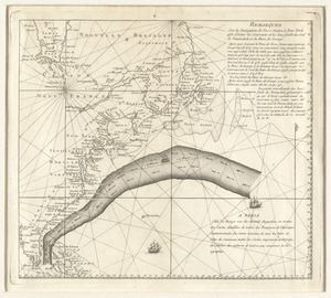
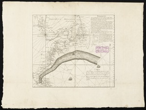
Remarques sur la navigation de terre-neuve à New-York afin d'eviter les courrants et les bas-fonds au sud de Nantuckett et du...
9.
Remarques sur la navigation de terre-neuve à New-York afin d'eviter les courrants et les bas-fonds au sud de Nantuckett et du...
10.
VIEW of BOSTON the Capital of NEW ENGLAND from Col. HATCH's House on the Road to DORCHESTER = VIEW FROM DORCHESTER NECK = VIEW...
11.
The White Mountains of New Hampshire
12.
The world turned upside down
13.
The 2100 project : an atlas for the Green New Deal
14.
The common school atlas : drawn and engraved on steel : to illustrate and accompany The introduction to modern geography [cover]
15.
Egmont Harbor
16.
Map of Massachusetts showing population according to United States Census of 1900 and congressional districts
17.
Map of parts of Boston Harbor and its tributaries
18.
Remarques sur la navigation de terre-neuve à New-York afin d'eviter les courrants et les bas-fonds au sud de Nantuckett et du...
19.
School atlas to Cummings' ancient & modern geography [cover]
20.
A plan of the city and environs of Philadelphia
21.
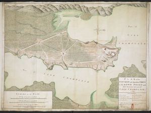
PLAN of the FORTRESS and dependant FORTS at CROWN POINT with their Environs and part of LAKE CHAMPLAIN. 1759
22.
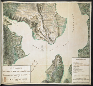
A SURVEY of the FORT at TIENDEROGA and its Environs, with the FRENCH LINES and part of LAKE CHAMPLAIN 1759
23.
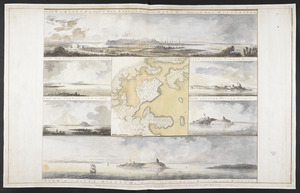
[Three views of South Carolina]
24.
Diagram of the Battle of Ball's Bluff
25.
The Evening Post map of the West Indies
26.
Fitz globe
27.
Noua, et integra vniuersi orbis descriptio
28.
A new map of Italy distinguishing all the sovereignties in it, whether states, kingdoms, dutchies, principalities, republicks,...
29.
View of Dedham, Mass. in 1876
30.
Meiguo Sanfan Shi hua qiao qu : xiang xi tu = Map of San Francisco Chinatown
31.
38,000,000 escaped -- 10,000,000 died


![Combat naval à la hauteur de la Baye de Chézapeake [sic] le 5 7bre. 1781](https://bpldcassets.blob.core.windows.net/derivatives/images/commonwealth:z603vn12t/image_thumbnail_300.jpg)


![School atlas to Cummings' ancient & modern geography [cover]](https://bpldcassets.blob.core.windows.net/derivatives/images/commonwealth:3f463152q/image_thumbnail_300.jpg)

![[Three views of South Carolina]](https://bpldcassets.blob.core.windows.net/derivatives/images/commonwealth:dz010v13q/image_thumbnail_300.jpg)