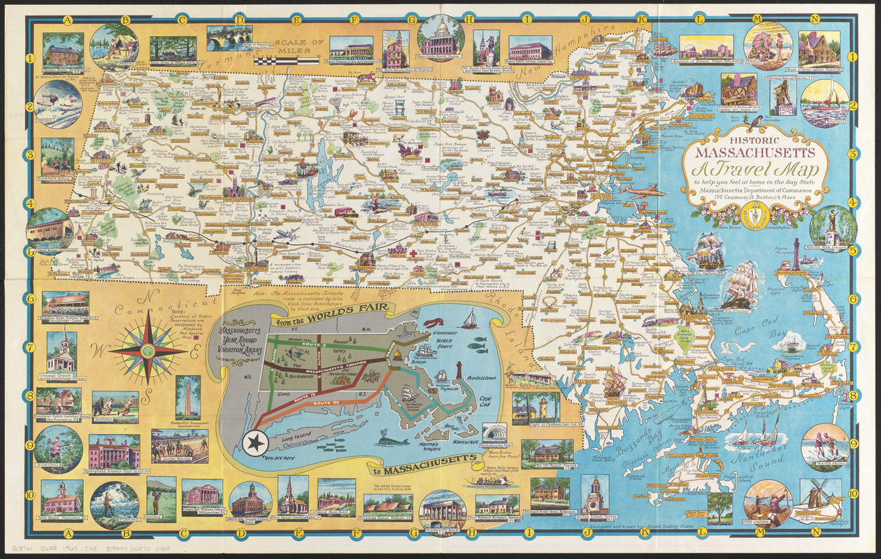
Historic Massachusetts : a travel map to help you feel at home in the Bay State
Item Information
- Title:
- Historic Massachusetts : a travel map to help you feel at home in the Bay State
- Title (alt.):
-
World of fun and relaxation - Massachusetts, the historic vacationland
- Cartographer:
- Chase, Ernest Dudley, 1878-1966
- Publisher:
- Massachusetts. Department of Commerce and Development
- Name on Item:
-
designed and drawn by Ernest Dudley Chase
- Date:
-
[1964]
- Format:
-
Maps/Atlases
- Location:
-
Boston Public Library
Norman B. Leventhal Map & Education Center - Collection (local):
-
Norman B. Leventhal Map & Education Center Collection
- Subjects:
-
Massachusetts--Maps
- Places:
-
Massachusetts
- Extent:
- 1 map : color ; 51 x 82 cm, folded to 14 x 22 cm
- Terms of Use:
-
No known copyright restrictions.
No known restrictions on use.
- Publisher:
-
Boston, Massachusetts :
Massachusetts Department of Commerce
- Scale:
-
Scale [ca. 1:380,160]
- Language:
-
English
- Notes:
-
Pictorial map.
Indexed.
Includes notes, pictorial index to points of interest, color illustrations, and inset: "Massachusetts year round vacation areas, from the World's Fair to Massachusetts."
Mileage chart, recreation area table, covered bridge index, calendar of events, text, illustrations (some color), and outline map of Massachusetts with pictorial index to points of interest on verso.
"Massachusetts Pavilion, New England States Exhibition New York World's Fair 1964-65."
"4-64-937759."
- Notes (date):
-
This date is inferred.
- Identifier:
-
06_01_014839
- Call #:
-
G3761.E635 1964 .C43
- Barcode:
-
39999065706424


