Toggle navigation
LMEC Home
Exhibitions
Georeferencing
Tools for Teachers
Collections
My Favorites
Sign Up / Log In
Search
Search the map portal
Map Collection
Map Collection
Map Sets
Search
Search
Search for
Search In
All Fields
Creator
Title
Subject
Place
Search All Digital Collections
Advanced Search
40 Results
My Search
Start Over
Ernest Dudley Chase
Remove constraint Ernest Dudley Chase
Filter your Search
Place
United States
16
North and Central America
10
World
10
Europe
4
Boston
3
Suffolk (county)
3
Germany
2
Great Britain
2
more
Place
»
Topic
World maps
10
Pictorial maps
7
United States--Maps
7
Boston (Mass.)--Maps
3
Stamp collecting--United States--Maps
3
World War, 1939-1945--Maps
3
Europe--Maps
2
Germany--Maps
2
more
Topic
»
Date
Date range begin
–
Date range end
Current results range from
1931
to
1964
View distribution
Creator
Chase, Ernest Dudley, 1878-1966
29
Chase, Ernest Dudley, 1878-
10
Kerr, Charles Peck
4
Massachusetts. Department of Commerce and Development
2
Whiting, Oliver K.
2
Chase, Ernest Dudley
1
Chase-O'Connell
1
Houghton Mifflin Company
1
more
Creator
»
Format
Maps/Atlases
40
Georeferenced
Yes
3
No
37
Collection
Norman B. Leventhal Map Center Collection
40
Boston and New England Maps
1
Available to use
No known restrictions
40
Search Constraints
Sort by relevance
relevance
title
date (asc)
date (desc)
Number of results to display per page
100 per page
10
per page
20
per page
50
per page
100
per page
View results as:
grid view
map view
Search Results
1.
Invasion and total war victory maps : with decorations, illustrations and military and naval insignia
2.
The story map of flying : being a chronicle of man's conquest of the air
3.
World freedom : a factual & pictorial map
4.
World wonders : a pictorial map
5.
Total war battle map
6.
The United States as viewed by California (very unofficial)
7.
A pictorial map of loveland
8.
Mercator map of the world united : a pictorial history of transport and communications and paths to permanent peace
9.
A pictorial stamp map of navigation and exploration
10.
The United States of America
11.
A pictorial map of North America
12.
America the wonderland : a pictorial map of the United States
13.
The pictorial map, United States stamps
14.
A pictorial map of the British Isles
15.
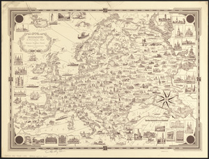
Europe : a pictorial map
16.
A pictorial map of the British Isles
17.
The victory war map
18.
Limited edition, 500 only of a pictorial map covering the New England States U.S.A
19.
France
20.
Boston (Massachusetts) and vicinity : a pictorial map
21.
Boston (Massachusetts) and vicinity : a pictorial map
22.
Boston (Massachusetts) and vicinity : a pictorial map
23.
Japan, the target : a pictorial Jap-map
24.
A pictorial map of the New England states U.S.A.
25.
The good neighbor pictorial map of South America
26.
A pictorial map of Germany
27.
A pictorial map of Germany
28.
Italy
29.
A pictorial map of that portion of New York City known as Manhattan, also showing parts of the Bronx
30.
Italy with Vatican City
31.
The pictorial map, stamps of America
32.
The pictorial map, stamps of the U.S.A.
33.
Peace map of the world united : a pictorial history of transportation and communications from Jonah to the jet plane as paths...
34.
The town of Winchester, Massachusetts
35.
The pictorial map, a world of stamps
36.
Mercator map of the world
37.
The town of Dedham, Massachusetts : a pictorial map
38.
Catholic America : a pictorial map portraying the contribution of Catholics in the development of the United States of America...
39.
Historic Massachusetts : a travel map to help you feel at home in the Bay State
40.
Historic Massachusetts : a travel map to help you feel at home in the Bay State