Toggle navigation
LMEC Home
Exhibitions
Georeferencing
Tools for Teachers
Collections
My Favorites
Sign Up / Log In
Search
Search the map portal
Map Collection
Map Collection
Map Sets
Search
Search
Search for
Search In
All Fields
Creator
Title
Subject
Place
Search All Digital Collections
Advanced Search
179 Results
My Search
Start Over
1884
Remove constraint 1884
Filter your Search
Place
North and Central America
146
United States
118
Suffolk (county)
35
Boston
34
Canada
13
New York
8
Europe
6
Middlesex (county)
6
more
Place
»
Topic
Boston (Mass.)--Maps
26
Fortification--Massachusetts--Boston--Maps
14
Landowners--Massachusetts--Boston--Maps
5
Real property--Massachusetts--Boston--Maps
5
Roxbury (Boston, Mass.)--Maps
5
Massachusetts--Maps
4
Cambridge (Mass.)--Maps
3
Charlestown (Boston, Mass.)--Maps
3
more
Topic
»
Date
Date range begin
–
Date range end
Current results range from
1694
to
1932
View distribution
Creator
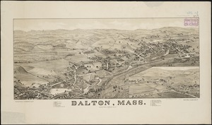
Boynton, George W., d. 1884
24
United States. Hydrographic Office
15
O.H. Bailey & Co
14
Geo. H. Walker & Co.
10
Johnson, A. J. (Alvin Jewett), 1827-1884
9
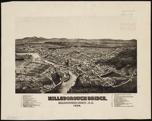
Boynton, George W., -1884
8
Campbell-Copeland, T. (Thomas)
7
Harper & Brothers
7
more
Creator
»
Format
Maps/Atlases
178
Books
3
Manuscripts
2
Prints
1
Georeferenced
Yes
21
No
158
Collection
Norman B. Leventhal Map Center Collection
167
Urban Maps
86
Boston and New England Maps
75
Maritime Charts and Atlases
20
Massachusetts Real Estate Atlases
6
Robert E. Diefenbach Map Collection at Phillips Academy
4
Mapping Boston Collection
1
Ralph Finos Map Collection at Phillips Academy
1
more
Collection
»
Available to use
No known restrictions
171
Creative Commons license
1
Search Constraints
Sort by date (asc)
relevance
title
date (asc)
date (desc)
Number of results to display per page
100 per page
10
per page
20
per page
50
per page
100
per page
View results as:
grid view
map view
Search Results
1.
A draught of Boston Harbor by Capt. Cyprian Southake
2.
Plan of Berkley, surveyor's name not given, dated August 1830
3.
New-England
4.
Boston
5.
Boston
6.
New York
7.
A new & complete map of the city of Boston, with part of Charlestown, Cambridge & Roxbury
8.
Retreat of the Marquis de Lafayette from Barren Hill, May 20th, 1778
9.
Apolima, Samoan Group ; Harbour of Oafonu, Isld. of Tutuila, north side ; Harbour of Aur, Isld. of Tutuila, north side ;...
10.
Harbours of Papieti, Toanoa, Papaoa and Matavai Bay, with the ship channel through reef, island of Tahiti
11.
Plan of the city of Boston
12.
Taputeouea or Drummond's Island, Kingsmill Group ; Peacock's anchorage at Drummond's Island, Kingsmill Group
13.
Map of the United States, from the latest surveys : with the heights of mountains and length of the principle rivers
14.
A new & complete map of the city of Boston, with part of Charlestown, Cambridge & Roxbury
15.
Plan of the city of Boston
16.
Map of the city of Lowell : surveyed in 1841 by order of the principal authorities
17.
Plan of the city of Boston
18.
Plan of the city of Boston
19.
Plan of the city of Boston
20.
A new & complete map of the city of Boston, with part of Charlestown, Cambridge & Roxbury
21.
Map of the vicinity of Boston
22.
A new & complete map of the city of Boston, and precincts including part of Charlestown, Cambridge & Roxbury : from the best...
23.
New map of Boston, comprising the whole city, with the new boundaries of the wards
24.
New map of Boston, comprising the whole city, with the new boundaries of the wards
25.
Map of New England exhibiting the rail road and telegraphic lines now in operation
26.
New map of Boston, comprising the whole city, with the new boundaries of the wards
27.
New map of Boston, comprising the whole city, with the new boundaries of the wards
28.
Map of the canals and rail roads for transporting anthracite coal from the several coal fields to the city of New York
29.
New map of Boston, comprising the whole city, with the new boundaries of the wards
30.
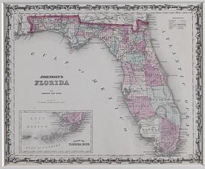
Johnson's Florida
31.
New map of Boston, comprising the whole city, with the new boundaries of the wards
32.
New map of Boston, comprising the whole city, with the new boundaries of the wards
33.
New map of Boston, comprising the whole city, with the new boundaries of the wards
34.
Johnson's new rail road & county copper plate map of the Southern States from the latest and best information
35.
New map of Boston, comprising the whole city, with the new boundaries of the wards
36.
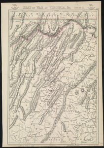
Seat of war in Virginia, &c
37.
New map of Boston, comprising the whole city, with the new boundaries of the wards
38.
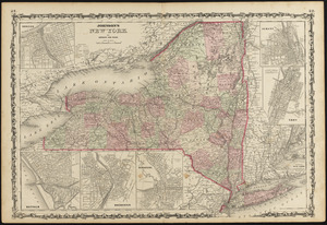
Johnson's New York
39.
Seat of war in Virginia
40.
Staaten am Atlantischen Ocean
41.
Colony of Queensland (Australia)
42.
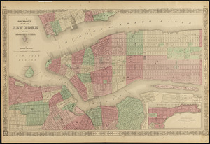
Johnson's map of New York and the adjacent cities
43.
Worcestershire and Gloucestershire
44.
Johnson's Massachusetts Connecticut and Rhode Island
45.
Johnson's new illustrated family atlas of the world, with physical geography, and with descriptions geographical, statistical,...
46.
Localities of one thousand cases of intestinal diseases (diarrhoea, cholera-infantum & dysentery) in children, for the months...
47.
Johnson's North America
48.
Philip's new plan of London
49.
Boston and vicinity
50.
Chikyū bankoku hōzu
51.
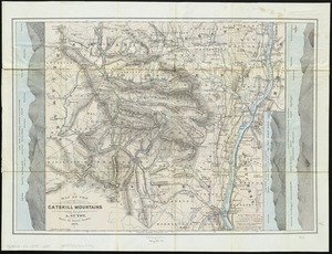
Map of the Catskill Mountains
52.
Johnson's Virginia, Delaware, Maryland & West Virginia
53.
Map of the Eastern Railroad and principal connections
54.
Arlington, Massachusetts : 1884
55.
Atlas of Essex County, Massachusetts
56.
Atlas of Greenfield town, Massachusetts
57.
Atlas of Greenfield Town, Massachusetts
58.
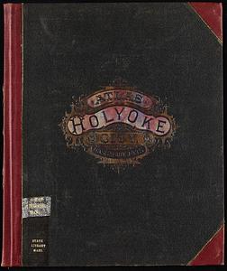
Atlas of Holyoke City, Massachusetts
59.
Atlas of Holyoke City, Massachusetts
60.
Atlas of Northampton City, Massachusetts
61.
Atlas of Spencer Town, Massachusetts
62.
Atlas of Spencer town, Massachusetts
63.
Atlas of the city of Boston : vol. 5, West Roxbury
64.
Atlas of the city of Boston : Dorchester : volume three : from actual surveys and official records
65.
Atlas of the city of Boston : Roxbury : volume two : from actual surveys and official records
66.
Atlas of the city of Boston : South & East Boston : volume four
67.
Atlas of the city of Boston : West Roxbury : volume five : from actual surveys and official records
68.
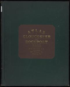
Atlas of the city of Gloucester and town of Rockport, Massachusetts : from official records, private plans and actual surveys
69.
Atlas of Westfield town, Massachusetts
70.
Atlas of Westfield town, Massachusetts
71.
Barre, Washington County, Vt : 1884
72.
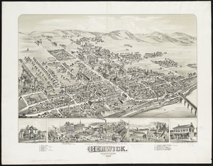
Berwick : Pennsylvania
73.
Bird's eye view of the village of Hyannis, Barnstable County, Mass
74.
Bristol, Grafton County, N.H. 1884
75.
A chart of Massachusetts Bay
76.
The city of Richmond, Indiana : 1884
77.
Clare, Mich : 1884
78.
Coleman, Michigan : 1884
79.
Colton's map of the New York Wilderness and the Adirondacks
80.
Dalton, Mass
81.
Danbury, Conn
82.
East Stroudsburg : Pennsylvania
83.
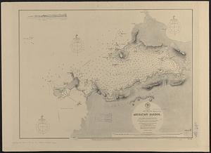
Eldridge's new chart of Boston Harbor : compiled from the latest surveys
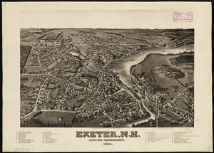
84.
Exeter, N.H : county seat of Rockingham County, 1884
85.
Franklin and Franklin Falls, N.H : Merrimack County, 1884
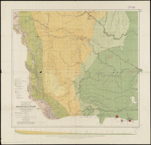
86.
Geological map of the region in the vicinity of the Bow and Belly Rivers : embracing the southern portion of the District of...
87.
The graphic map of European possessions in Africa
88.
Great Barrington, Mass
89.
Hazleton : Pennsylvania
90.
Hillsborough-Bridge, Hillsborough County, N.H : 1884
91.
How the public domain has been squandered, map showing the 139,403,026 acres of the people's land - equal to 871,268 farms of...
92.
Japan, Nipon-- west coast, Aburatani Harbor (Igama Bay) : from a Japanese government survey, 1879, with additions by Mr. J.C....
93.
Lebanon, Grafton County, N.H : 1884
94.
Lewisburgh : Pennsylvania
95.
Lyndonville, Caledonia County, Vermont : 1884
96.
Manchester Ship Canal : general map of the district showing canals, rivers, railways, and roads
97.
Map of Boston, 1884
98.
Map of Boston, for 1884
99.
Map of Boyd, Carter and Greenup Counties
100.
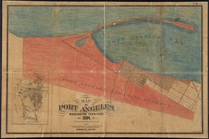
Map of Port Angeles, Washington Territory : compiled from a true copy of the U.S. survey thereof on file in the General Land...
‹ Prev
Next ›
1
2


![Johnson's new illustrated family atlas of the world, with physical geography, and with descriptions geographical, statistical, and historical, including the latest federal census, and the existing religious denominations in the world [frontispiece]](https://bpldcassets.blob.core.windows.net/derivatives/images/commonwealth:0r96fp61c/image_thumbnail_300.jpg)