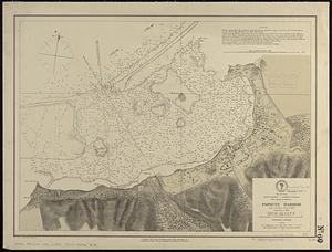
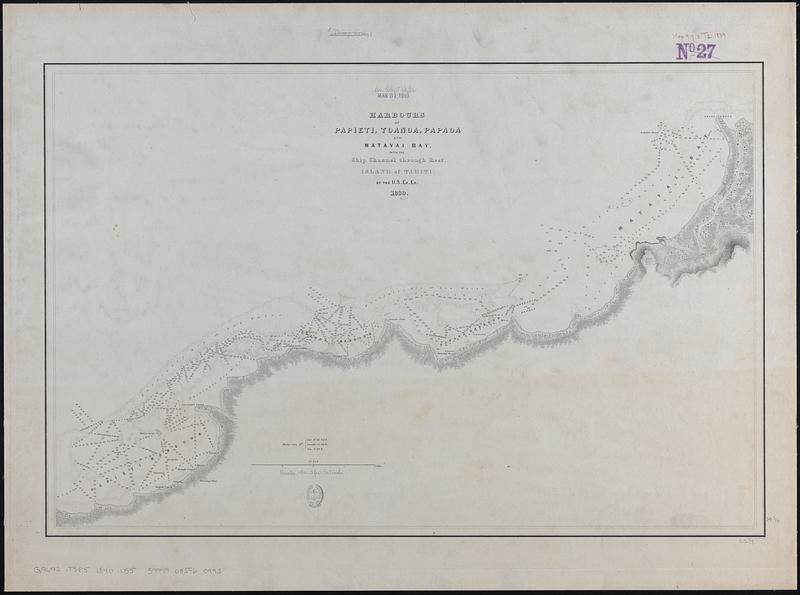
Harbours of Papieti, Toanoa, Papaoa and Matavai Bay, with the ship channel through reef, island of Tahiti
Item Information
- Title:
- Harbours of Papieti, Toanoa, Papaoa and Matavai Bay, with the ship channel through reef, island of Tahiti
- Contributor:
- Wilkes, Charles, 1798-1877
- Engraver:
- Boynton, George W., -1884
- Cartographer:
- United States Exploring Expedition (1838-1842)
- Name on Item:
-
by the U.S. Ex. Ex. 1839
- Date:
-
[ca. 1840–1849]
- Format:
-
Maps/Atlases
- Genre:
-
Nautical charts
- Location:
-
Boston Public Library
Norman B. Leventhal Map & Education Center - Collection (local):
-
Norman B. Leventhal Map & Education Center Collection
- Subjects:
-
Tahiti (French Polynesia : Island)--Maps
Harbors--French Polynesia--Papava--Maps
Harbors--French Polynesia--Taunoa--Maps
Harbors--French Polynesia--Papeete--Maps
Coasts--French Polynesia--Tahiti (Island)--Maps
Navigation--French Polynesia--Matavai Bay
- Places:
-
French Polynesia (territory)Taunoa
French Polynesia (territory)Papeete
Papawa
- Extent:
- 1 map ; 38 x 58 cm
- Terms of Use:
-
No known copyright restrictions.
No known restrictions on use.
- Publisher:
-
[Place of publication not identified] :
[publisher not identified]
- Scale:
-
Scale approximately 1:18,000
- Language:
-
English
- Notes:
-
Relief shown by hachures. Depths shown by soundings and pictorially.
Published in Narrative of the United States Exploring Expedition : during the years 1838, 1839, 1840, 1841, 1842.
- Identifier:
-
06_01_017650
- Call #:
-
G9642.T3P5 1840 .U55
- Barcode:
-
39999085960993