Toggle navigation
LMEC Home
Exhibitions
Georeferencing
Tools for Teachers
Collections
My Favorites
Sign Up / Log In
Search
Search the map portal
Map Collection
Map Collection
Map Sets
Search
Search
Search for
Search In
All Fields
Creator
Title
Subject
Place
Search All Digital Collections
Advanced Search
14021 Results
Filter your Search
Place
North and Central America
10,683
United States
8,692
Massachusetts
2,808
Suffolk (county)
1,682
Boston
1,638
Europe
1,420
Canada
1,009
New York
674
more
Place
»
Topic
Boston (Mass.)--Maps
748
City planning--Massachusetts--Boston--Maps
418
United States--History--Revolution, 1775-1783--Maps
331
United States--Maps
328
Real property--Massachusetts--Boston--Maps
254
Urban renewal--Massachusetts--Boston--Maps
254
North America--Maps--Early works to 1800
240
Massachusetts--Maps
234
more
Topic
»
Date
Date range begin
–
Date range end
Current results range from
1482
to
2023
View distribution
Creator
United States. Hydrographic Office
597
Boston Redevelopment Authority
404
Des Barres, Joseph F. W. (Joseph Frederick Wallet), 1722-1824
247
Jefferys, Thomas, -1771
172
Royal United Services Institute for Defence and Security Studies
160
George, III, King of Great Britain, 1738-1820
152
George, IV, King of Great Britain, 1762-1830
151
O.H. Bailey & Co
148
more
Creator
»
Format
Maps/Atlases
13,839
Manuscripts
985
Prints
102
Books
49
Drawings/Illustrations
44
Photographs
15
Objects/Artifacts
13
Documents
7
more
Format
»
Georeferenced
Yes
979
No
13,042
Collection
Norman B. Leventhal Map & Education Center Collection
9,110
American Revolutionary War-Era Maps
3,627
Boston and New England Maps
2,921
Urban Maps
2,480
Maritime Charts and Atlases
1,169
William L. Clements Library Collection
910
Library of Congress Collection
618
Boston Redevelopment Authority Collection
475
more
Collection
»
Available to use
No known restrictions
10,268
Creative Commons license
1,678
Search Constraints
Sort by relevance
relevance
title
date (asc)
date (desc)
Number of results to display per page
20 per page
10
per page
20
per page
50
per page
100
per page
View results as:
grid view
map view
Search Results
7841.
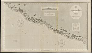
North America, west coast of Mexico, Chamela Bay to Maldonado : surveyed by the officers of the U.S.S. Tuscarora in 1878-9 and...
7842.
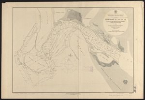
North America, west coast of Mexico, eastern shore of the Gulf of California, harbor of Altata
7843.
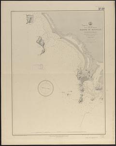
North America, west coast of Mexico, harbor of Mazatlan : from British surveys in 1828 & 1863 corrected for the latest information
7844.
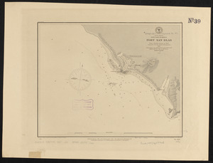
North America, west coast of Mexico, Port San Blas : from a British survey in 1822, corrected for the latest information, 1887
7845.
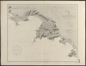
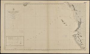
North America, west coast of Mexico, Tenacatita and Navidad Bays : surveyed by the officers of the U.S.S. Ranger, Commander...
7846.
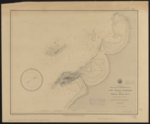
North America, west coast of Newfoundland, Cow Head Harbor and White Rock Bay : from French surveys in 1857 & 1881
7847.
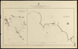
North America, west coast, ports on the west coast of Lower California : from British surveys in 1847, with additions by Comdr....
7848.
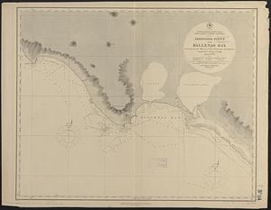
North America, west coast, west coast of lower California, Abreojos Point and Ballenas Bay
7849.
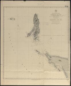
North America, west coast, west coast of lower California, Cerros Island and vicinity
7850.
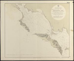
North America, west coast, west coast of lower California, preliminary chart of Magdalena Bay : chiefly from a survey of a U.S....
7851.
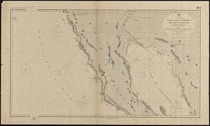
North America, west coast, west coast of Mexico and the Gulf of California : from a survey by Comdr. Geo. Dewey U.S.N., and the...
7852.
North America, west coast, west coast of Mexico from Chipequa Pt. to Ventosa Bay : showing the anchorages in Chipequa, Conejo,...
7853.
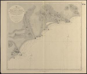
North America, west coast, west coast of Mexico from Mazatlan to Tenacatita Bay : from a survey made by Comdr. Geo. Dewey...
7854.
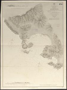
North America, west coast, west coast of Mexico, harbor of Acapulco : from a survey by Commander J.W. Philip, U.S.N. and the...
7855.
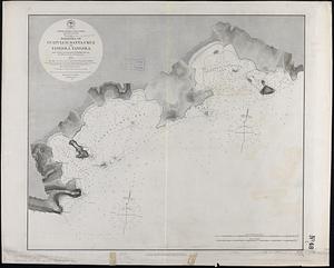
North America, west coast, west coast of Mexico, harbors of Guatulco, Santa Cruz and Tangola Tangola : from a survey by...
7856.
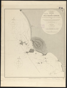
North America, west coast, west coast of Mexico, Istapa or Isla Grande Harbor : from a survey by Commander J.W. Philip, U.S.N....
7857.
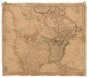
North America, west coast, west coast of Mexico, Manzanilla and Santiago Bays : from a survey by Commander J.W. Philip U.S.N.,...
7858.
North America with the new discoveries
7859.
North America with the West India islands
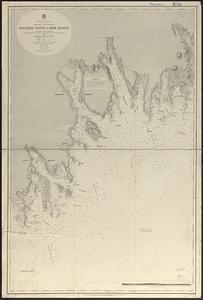
7860.
North America--east coast, Nova Scotia--south east coast, Baccaro Point to Ram Island
‹ Prev
Next ›
1
2
…
389
390
391
392
393
394
395
396
397
…
701
702