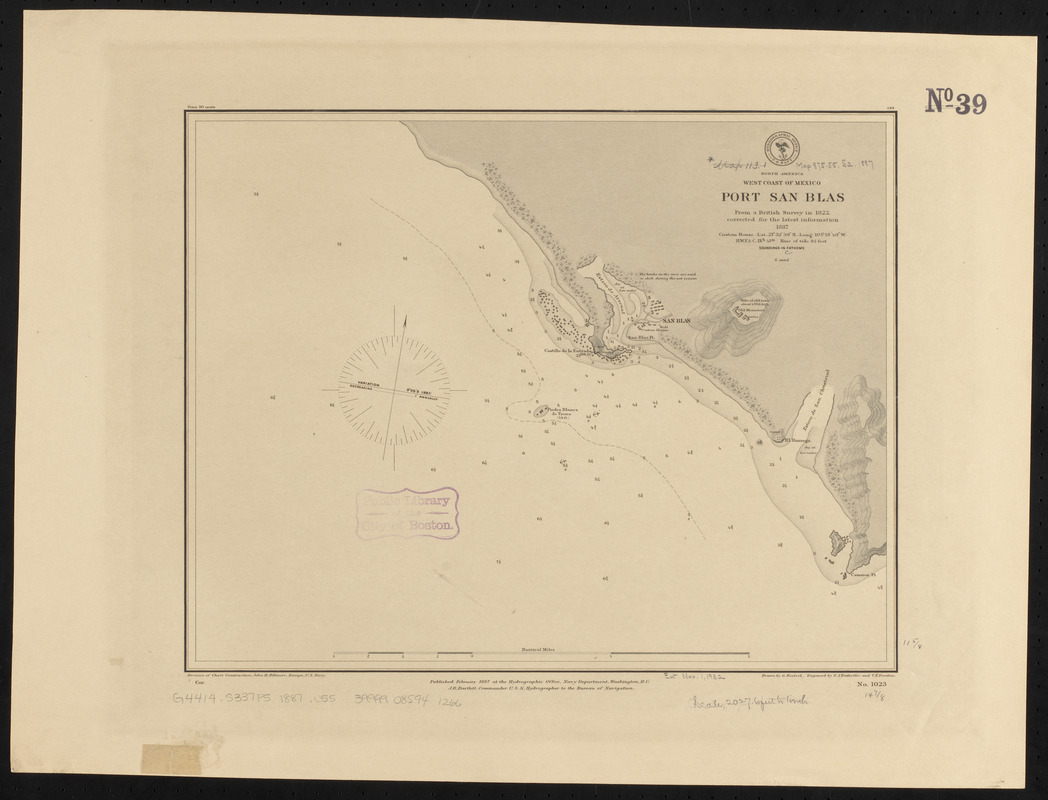
North America, west coast of Mexico, Port San Blas : from a British survey in 1822, corrected for the latest information, 1887
Item Information
- Title:
- North America, west coast of Mexico, Port San Blas : from a British survey in 1822, corrected for the latest information, 1887
- Title (alt.):
-
Port San Blas
- Issuing body:
- United States. Hydrographic Office
- Engraver:
- Enthoffer, E. J. (Edward J.)
- Draftsman:
- Noetzel, G. (Gregor)
- Engraver:
- Ourdan, V. L. (Vincent L.)
- Name on Item:
-
drawn by G. Noetzel ; engraved by E.J. Enthoffer and V.L. Ourdan
- Date:
-
1887
- Format:
-
Maps/Atlases
- Location:
-
Boston Public Library
Norman B. Leventhal Map & Education Center - Collection (local):
-
Norman B. Leventhal Map & Education Center Collection
- Subjects:
-
Harbors--Mexico--San Blas--Maps
Nautical charts--Mexico--San Blas
San Blas (Mexico)--Maps
- Places:
-
MexicoNayaritSan Blas
- Extent:
- 1 map ; 30 x 38 cm
- Terms of Use:
-
No known copyright restrictions.
No known restrictions on use.
- Publisher:
-
Washington, D.C. :
Hydrographic Office
- Scale:
-
Scale approximately 1:24,400
- Language:
-
English
- Notes:
-
Relief shown by contours, shading and spot heights. Depths shown by soundings and isolines.
- Identifier:
-
06_01_015818
- Call #:
-
G9096.P5 svar .U55
- Barcode:
-
39999085941266


