Toggle navigation
LMEC Home
Exhibitions
Georeferencing
Tools for Teachers
Collections
My Favorites
Sign Up / Log In
Search
Search the map portal
Map Collection
Map Collection
Map Sets
Search
Search
Search for
Search In
All Fields
Creator
Title
Subject
Place
Search All Digital Collections
Advanced Search
14020 Results
Filter your Search
Place
North and Central America
10,683
United States
8,692
Massachusetts
2,808
Suffolk (county)
1,682
Boston
1,638
Europe
1,420
Canada
1,009
New York
674
more
Place
»
Topic
Boston (Mass.)--Maps
748
City planning--Massachusetts--Boston--Maps
418
United States--History--Revolution, 1775-1783--Maps
331
United States--Maps
328
Real property--Massachusetts--Boston--Maps
254
Urban renewal--Massachusetts--Boston--Maps
254
North America--Maps--Early works to 1800
240
Massachusetts--Maps
234
more
Topic
»
Date
Date range begin
–
Date range end
Current results range from
1482
to
2023
View distribution
Creator
United States. Hydrographic Office
597
Boston Redevelopment Authority
404
Des Barres, Joseph F. W. (Joseph Frederick Wallet), 1722-1824
247
Jefferys, Thomas, -1771
172
Royal United Services Institute for Defence and Security Studies
160
George, III, King of Great Britain, 1738-1820
152
George, IV, King of Great Britain, 1762-1830
151
O.H. Bailey & Co
148
more
Creator
»
Format
Maps/Atlases
13,838
Manuscripts
985
Prints
102
Books
49
Drawings/Illustrations
44
Photographs
15
Objects/Artifacts
13
Documents
7
more
Format
»
Georeferenced
Yes
979
No
13,041
Collection
Norman B. Leventhal Map & Education Center Collection
9,109
American Revolutionary War-Era Maps
3,627
Boston and New England Maps
2,921
Urban Maps
2,479
Maritime Charts and Atlases
1,169
William L. Clements Library Collection
910
Library of Congress Collection
618
Boston Redevelopment Authority Collection
475
more
Collection
»
Available to use
No known restrictions
10,267
Creative Commons license
1,678
Search Constraints
Sort by relevance
relevance
title
date (asc)
date (desc)
Number of results to display per page
20 per page
10
per page
20
per page
50
per page
100
per page
View results as:
grid view
map view
Search Results
6781.
Massachusetts
6782.
Massachusetts : eastern part, no.11
6783.
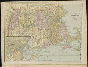
Massachusetts and Rhode Island
6784.
Massachusetts and Rhode Island
6785.
Massachusetts and Rhode Island
6786.
Massachusetts and Rhode Island
6787.
Massachusetts areas of critical environmental concern
6788.
Massachusetts Bay Transportation Authority
6789.
Massachusetts Bay Transportation Authority system map
6790.
Massachusetts Bay Transportation Authority system route map
6791.
Massachusetts Bay Transportation Authority system route map
6792.
Massachusetts Bay with the coast from Cape Ann to Cape Cod
6793.
Massachusetts Bays Program community resource atlas
6794.
Massachusetts, Boston sheet
6795.
Massachusetts coastal towns
6796.
Massachusetts coastal watersheds
6797.
Massachusetts coastal zone management
6798.
Massachusetts coastal zone management program : volume 1, summary map
6799.
Massachusetts CZM shoreline change analysis project
6800.
Massachusetts drainage basins
‹ Prev
Next ›
1
2
…
336
337
338
339
340
341
342
343
344
…
700
701