Toggle navigation
LMEC Home
Exhibitions
Georeferencing
Tools for Teachers
Collections
My Favorites
Sign Up / Log In
Search
Search the map portal
Map Collection
Map Collection
Map Sets
Search
Search
Search for
Search In
All Fields
Creator
Title
Subject
Place
Search All Digital Collections
Advanced Search
14164 Results
Filter your Search
Place
North and Central America
10,832
United States
8,868
Massachusetts
2,832
Suffolk (county)
1,688
Boston
1,644
Europe
1,428
Canada
1,010
New York
684
more
Place
»
Topic
Boston (Mass.)--Maps
753
City planning--Massachusetts--Boston--Maps
419
United States--History--Revolution, 1775-1783--Maps
331
United States--Maps
331
Real property--Massachusetts--Boston--Maps
254
Urban renewal--Massachusetts--Boston--Maps
254
North America--Maps--Early works to 1800
241
Massachusetts--Maps
236
more
Topic
»
Date
Date range begin
–
Date range end
Current results range from
1482
to
2023
View distribution
Creator
United States. Hydrographic Office
597
Boston Redevelopment Authority
404
Des Barres, Joseph F. W. (Joseph Frederick Wallet), 1722-1824
247
Jefferys, Thomas, -1771
172
United States. National Ocean Service
170
Royal United Services Institute for Defence and Security Studies
160
George, III, King of Great Britain, 1738-1820
152
George, IV, King of Great Britain, 1762-1830
151
more
Creator
»
Format
Maps/Atlases
13,978
Manuscripts
985
Prints
102
Books
53
Drawings/Illustrations
44
Photographs
15
Objects/Artifacts
13
Documents
7
more
Format
»
Georeferenced
Yes
979
No
13,185
Collection
Norman B. Leventhal Map & Education Center Collection
9,162
American Revolutionary War-Era Maps
3,629
Boston and New England Maps
2,936
Urban Maps
2,511
Maritime Charts and Atlases
1,169
William L. Clements Library Collection
910
Library of Congress Collection
618
Boston Redevelopment Authority Collection
475
more
Collection
»
Available to use
No known restrictions
10,408
Creative Commons license
1,678
Search Constraints
Sort by relevance
relevance
title
date (asc)
date (desc)
Number of results to display per page
20 per page
10
per page
20
per page
50
per page
100
per page
View results as:
grid view
map view
Search Results
6841.
A Mappe of Colonel Römers Voyage to ye: 5 Indian nations going from New Yorck to Albany thence west to ye 3 Macquas Castle and...
6842.
Mappe-monde
6843.
Mappemonde ou Description du globe terrestre
6844.
Mappemonde projetée sur l'horizon d'Angers
6845.
Mappmonde ou description generale du globe terrestre
6846.
Maps from General plan for Boston : preliminary report, December, 1950
6847.
Maps illustrating cruises of John Paul Jones in British waters : [Great Britain and Ireland]
6848.
Map[s] illustrating the military operations of the Atlanta campaign ... 1864
6849.
Maps of Beverly
6850.
Maps of Dorchester and Quincy
6851.
Maps of Europe
6852.
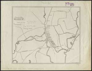
Maps of Providence, R.I., 1650, 1765, 1770
6853.
Maps of the Far East, illustrating Russo-Japanese War
6854.
Maps of the street-lines of Boston : made for the Selectmen in 1819 and 1820
6855.
Maps of the vicinities of thirty-two of the principal cities and towns in the Union
6856.
Maps showing the range, and, within the range, the degree of cultivation of certain principal crops
6857.
Maps showing the Toledo, Delphos & Burlington Railroad and its connections
6858.
Maps with a moral
6859.
Mar del nort
6860.
Marathon, Wis.
‹ Prev
Next ›
1
2
…
339
340
341
342
343
344
345
346
347
…
708
709


![Map[s] illustrating the military operations of the Atlanta campaign ... 1864](https://bpldcassets.blob.core.windows.net/derivatives/images/commonwealth:3f463432v/image_thumbnail_300.jpg)