Toggle navigation
LMEC Home
Exhibitions
Georeferencing
Tools for Teachers
Collections
My Favorites
Sign Up / Log In
Search
Search the map portal
Map Collection
Map Collection
Map Sets
Search
Search
Search for
Search In
All Fields
Creator
Title
Subject
Place
Search All Digital Collections
Advanced Search
13385 Results
Filter your Search
Place
North and Central America
10,111
United States
8,249
Massachusetts
2,691
Suffolk (county)
1,664
Boston
1,621
Europe
1,386
Canada
949
New York
640
more
Place
»
Topic
Boston (Mass.)--Maps
741
City planning--Massachusetts--Boston--Maps
418
United States--History--Revolution, 1775-1783--Maps
329
United States--Maps
315
Urban renewal--Massachusetts--Boston--Maps
254
Real property--Massachusetts--Boston--Maps
252
Massachusetts--Maps
219
Insurance surveys
197
more
Topic
»
Date
Date range begin
–
Date range end
Current results range from
1482
to
2023
View distribution
Creator
United States. Hydrographic Office
595
Boston Redevelopment Authority
403
Des Barres, Joseph F. W. (Joseph Frederick Wallet), 1722-1824
247
Royal United Services Institute for Defence and Security Studies
160
Jefferys, Thomas, -1771
154
George, III, King of Great Britain, 1738-1820
152
George, IV, King of Great Britain, 1762-1830
151
O.H. Bailey & Co
148
more
Creator
»
Format
Maps/Atlases
13,205
Manuscripts
985
Prints
102
Books
49
Drawings/Illustrations
44
Photographs
15
Objects/Artifacts
13
Documents
7
more
Format
»
Georeferenced
Yes
979
No
12,406
Collection
Norman B. Leventhal Map & Education Center Collection
8,891
American Revolutionary War-Era Maps
3,305
Boston and New England Maps
2,804
Urban Maps
2,397
Maritime Charts and Atlases
1,150
William L. Clements Library Collection
910
Library of Congress Collection
618
Boston Redevelopment Authority Collection
475
more
Collection
»
Available to use
No known restrictions
9,952
Creative Commons license
1,677
Search Constraints
Sort by relevance
relevance
title
date (asc)
date (desc)
Number of results to display per page
20 per page
10
per page
20
per page
50
per page
100
per page
View results as:
grid view
map view
Search Results
6801.
A new and accurate chart of the harbour of Boston, in New England, in North America
6802.
A new and accurate chart of the harbour of Boston in New England in North America
6803.
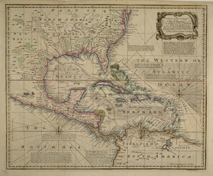
A new and accurate chart of the West Indies : with the adjacent coasts of North and South America
6804.
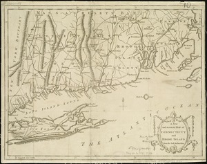
A new and accurate map of Connecticut and Rhode Island from the best authorities
6805.
A new and accurate map of Connecticut and Rhode Island, from the best authorities
6806.
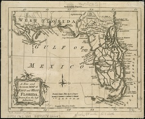
A New and accurate map of East and West Florida, drawn from the best authorities
6807.
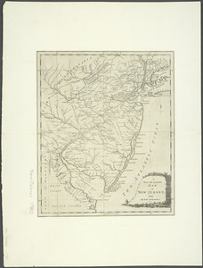
A New and accurate map of New Jersey : from the best authorities
6808.
A new and accurate map of New Jersey, from the best authorities
6809.
A new and accurate map of New Jersey, Pensilvania, New York and New England : with the adjacent countries. Drawn from surveys,...
6810.
A new and accurate map of North America : laid down according to the latest, and most approved observations and discoveries
6811.
A new and accurate map of North America
6812.
A new and accurate map of North America : laid down according to the latest, and most approved observations and discoveries
6813.
A new and accurate map of North America laid down according to the latest and most approved observations, and discoveries
6814.
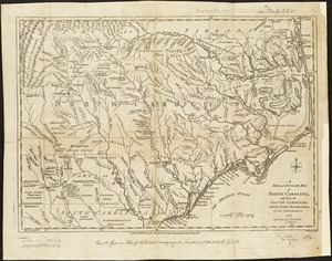
A new and accurate map of North Carolina, and part of South Carolina, with the field of battle between Earl Cornwalis and...
6815.
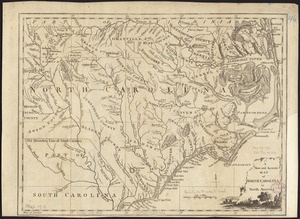
A new and accurate map of North Carolina in North America
6816.
A new and accurate map of Quebec and its boundaries: from a late survey
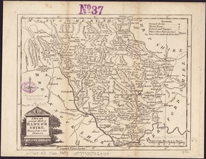
6817.
A New and accurate map of Radnor Shire
6818.
A New and accurate map of the chief parts of South Carolina, and Georgia
6819.
A new and accurate map of the colony of Massachusets Bay, in North America, from a late survey
6820.
A new and accurate map of the colony of Massachusets Bay, in North America, from a late survey
‹ Prev
Next ›
1
2
…
337
338
339
340
341
342
343
344
345
…
669
670