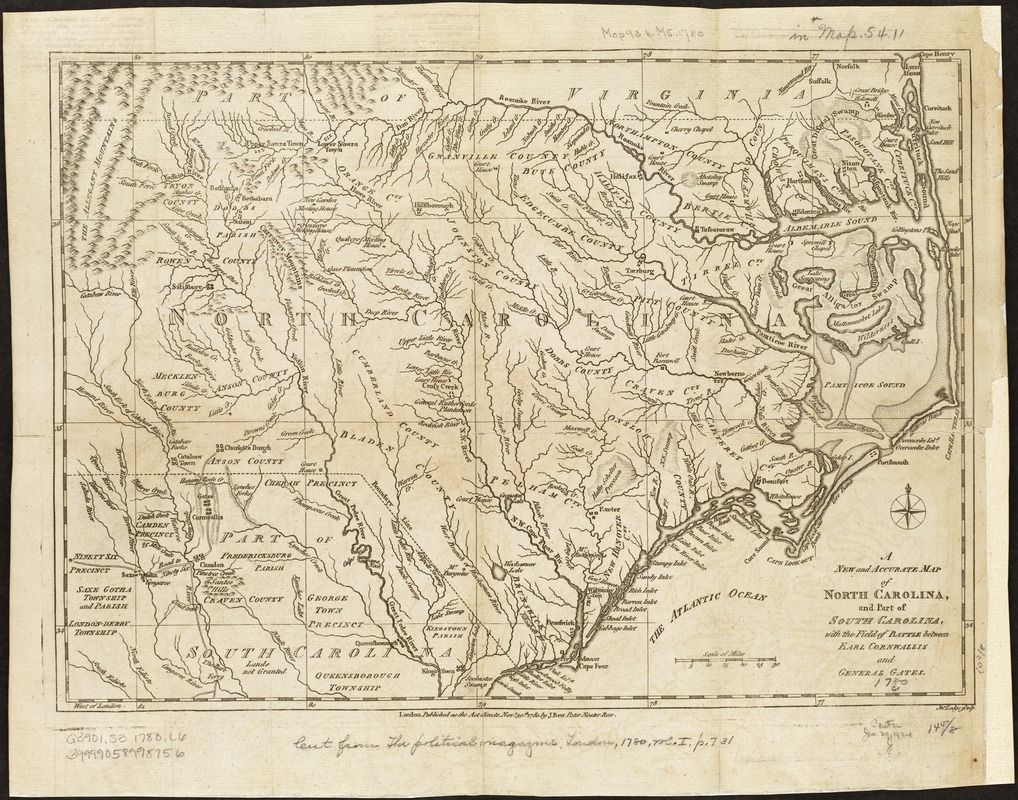
A new and accurate map of North Carolina, and part of South Carolina, with the field of battle between Earl Cornwalis and General Gates
This map is also available in American Revolutionary Geographies Online (ARGO), a collections portal especially built for material relating to the American Revolutionary War Era. Visit ARGO to learn more about this item and explore the historical geography of North America in the late eighteenth century.
Item Information
- Title:
- A new and accurate map of North Carolina, and part of South Carolina, with the field of battle between Earl Cornwalis and General Gates
- Creator:
- Lodge, John, d. 1796
- Name on Item:
-
Jno. Lodge sculp.
- Date:
-
1780
- Format:
-
Maps/Atlases
- Location:
-
Boston Public Library
Norman B. Leventhal Map & Education Center - Collection (local):
-
Norman B. Leventhal Map & Education Center Collection
- Subjects:
-
North Carolina--History--Revolution, 1775-1783--Maps--Early works to 1800
South Carolina--History--Revolution, 1775-1783--Maps--Early works to 1800
- Places:
-
North Carolina
South Carolina
- Extent:
- 1 map ; 27 x 38 cm.
- Terms of Use:
-
No known copyright restrictions.
No known restrictions on use.
- Publisher:
-
London :
Published as the Act directs ... by J. Bew
- Scale:
-
Scale [ca. 1:1,300,000]
- Language:
-
English
- Notes:
-
Relief shown pictorially.
Appears in The Political Magazine, London, 1780, vol. 1, p.731.
- Identifier:
-
06_01_003130
- Call #:
-
G3901.S3 1780 .L6
- Barcode:
-
39999058998756