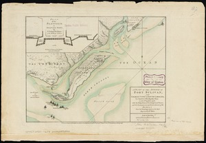
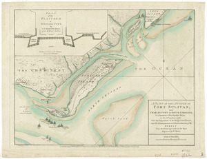
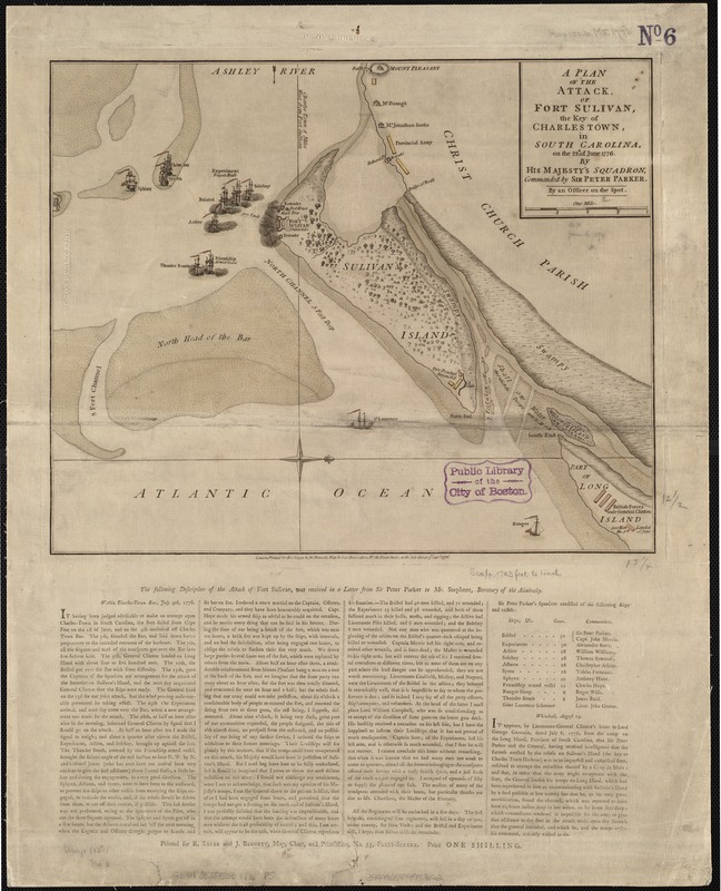
A plan of the attack of Fort Sulivan, the key of Charlestown, in South Carolina, on the 28th. of June 1776 : by His Majesty's squadron, commanded by Sir Peter Parker
This map is also available in American Revolutionary Geographies Online (ARGO), a collections portal especially built for material relating to the American Revolutionary War Era. Visit ARGO to learn more about this item and explore the historical geography of North America in the late eighteenth century.
Item Information
- Title:
- A plan of the attack of Fort Sulivan, the key of Charlestown, in South Carolina, on the 28th. of June 1776 : by His Majesty's squadron, commanded by Sir Peter Parker
- Name on Item:
-
by an officer on the spot.
- Date:
-
1776
- Format:
-
Maps/Atlases
- Location:
-
Boston Public Library
Norman B. Leventhal Map & Education Center - Collection (local):
-
Norman B. Leventhal Map & Education Center Collection
- Subjects:
-
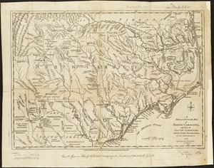
Fort Moultrie, Battle of, S.C., 1776--Maps--Early works to 1800
Fortification--South Carolina--Maps--Early works to 1800
South Carolina--History--Revolution, 1775-1783--Maps--Early works to 1800
- Places:
-
South CarolinaCharleston (county)Fort Moultrie
- Extent:
- 1 map : col. ; 32 x 39 cm.
- Terms of Use:
-
No known copyright restrictions.
No known restrictions on use.
- Publisher:
-
London :
Printed for Robt. Sayer & Jno. Bennett
- Scale:
-
Scale ca. 1:20,700.
- Language:
-
English
- Notes:
-
Hand colored.
Oriented with north to the right.
British squadron represented pictorially.
In lower margin: The following description of the attack of Fort Sulivan, was received in a letter from Sir Peter Parker to Mr. Stephens, Secretary of the Admiralty.
- Identifier:
-
06_01_003138
- Call #:
-
G3914.C3:2F5S3 1776 .P5
- Barcode:
-
39999058998822
- LCCN:
-
gm 71002458