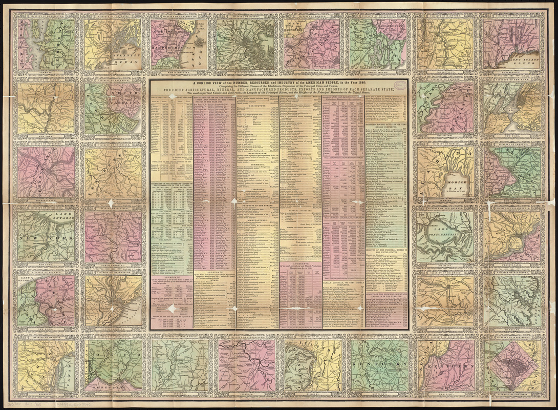
Maps of the vicinities of thirty-two of the principal cities and towns in the Union
Item Information
- Title:
- Maps of the vicinities of thirty-two of the principal cities and towns in the Union
- Cartographer:
- Young, J. H. (James Hamilton)
- Engraver:
- Brightly, Joseph H., 1818-1901
- Name on Item:
-
drawn by J.H. Young ; engraved by J.H. Brightly
- Date:
-
1843
- Format:
-
Maps/Atlases
- Location:
-
Boston Public Library
Norman B. Leventhal Map & Education Center - Collection (local):
-
Norman B. Leventhal Map & Education Center Collection
- Subjects:
-
Cities and towns--United States--Maps
- Places:
-
United States
- Extent:
- 32 maps on 1 sheet : col. ; 62 x 84 cm.
- Terms of Use:
-
No known copyright restrictions.
No known restrictions on use.
- Publisher:
-
Philadelphia :
S. Augustus Mitchell
- Scale:
-
Scales differ
- Language:
-
English
- Notes:
-
Accompanies "Mitchell's national map of the American Republic or United States of North America : together with maps of the vicinities of thirty-two of the principal cities and towns in the Union".
- Identifier:
-
06_01_009706
- Call #:
-
G3700 1843 .Y68
- Barcode:
-
39999065663542


