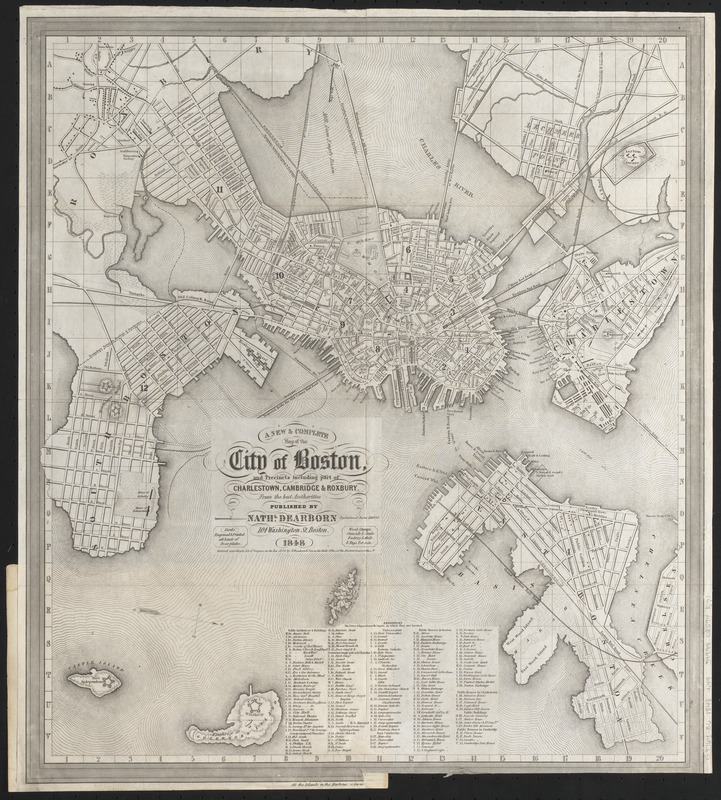
A new & complete map of the city of Boston, and precincts including part of Charlestown, Cambridge & Roxbury : from the best authorities
Item Information
- Title:
- A new & complete map of the city of Boston, and precincts including part of Charlestown, Cambridge & Roxbury : from the best authorities
- Title (alt.):
-
New and complete map of the city of Boston, and precincts including part of Charlestown, Cambridge and Roxbury
- Publisher:
- Dearborn, Nathaniel, 1786-1852
- Date:
-
1848
- Format:
-
Maps/Atlases
- Location:
-
Boston Public Library
Norman B. Leventhal Map & Education Center - Collection (local):
-
Norman B. Leventhal Map & Education Center Collection
- Subjects:
-
Boston (Mass.)--Maps
- Places:
-
MassachusettsSuffolk (county)Boston
- Extent:
- 1 map ; 43 x 39 cm
- Terms of Use:
-
No known copyright restrictions.
No known restrictions on use.
- Publisher:
-
Boston :
Nathl. Dearborn
- Scale:
-
Scale approximately 1:17,000
- Language:
-
English
- Notes:
-
Relief shown by hachures.
Oriented with north to the right.
Shows streets, wharves, wards, boundaries and railroads.
Includes index to public institutions and buildings, churches, and public houses.
"Entered according to Act of Congress, in the year 1839, by N. Dearborn & Son, in the Clerk's Office of the District Court of Massts."
- Identifier:
-
06_01_016067
- Call #:
-
G3764.B6 1848 .N49
- Barcode:
-
39999085941571


