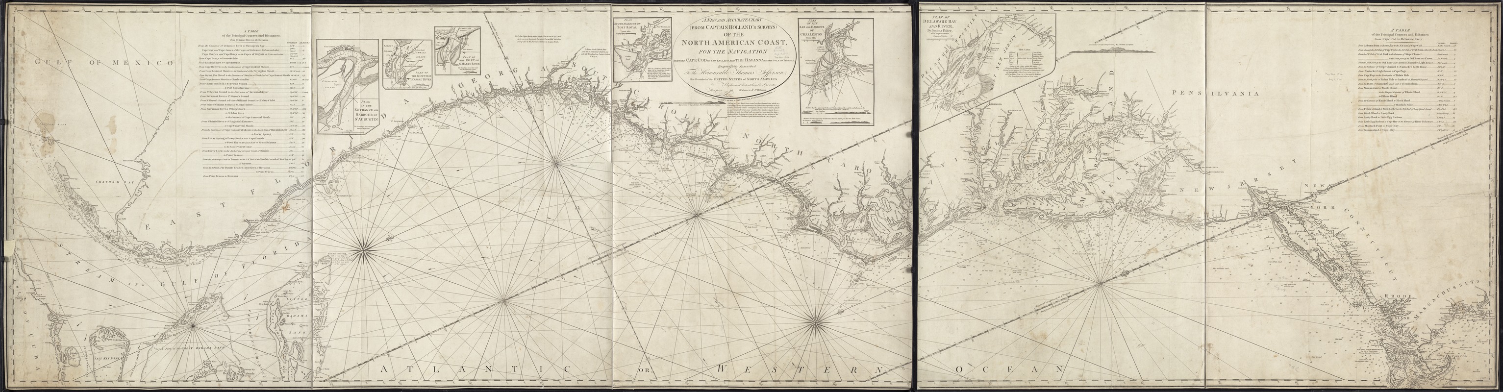
A new and accurate chart (from Captain Holland's surveys) of the North American coast, for the navigation between Cape Cod in New England, and the Havanna in the Gulf of Florida
This map is also available in American Revolutionary Geographies Online (ARGO), a collections portal especially built for material relating to the American Revolutionary War Era. Visit ARGO to learn more about this item and explore the historical geography of North America in the late eighteenth century.
Item Information
- Title:
- A new and accurate chart (from Captain Holland's surveys) of the North American coast, for the navigation between Cape Cod in New England, and the Havanna in the Gulf of Florida
- Creator:
- Robert Laurie and James Whittle
- Name on Item:
-
Rt. Laurie & J. Whittle.
- Date:
-
1800
- Format:
-
Maps/Atlases
- Location:
-
Boston Public Library
Norman B. Leventhal Map & Education Center - Collection (local):
-
Norman B. Leventhal Map & Education Center Collection
- Subjects:
-
Nautical charts--Atlantic Coast (North America)
Atlantic Coast (North America)--Maps
- Places:
-
North America (area)
- Extent:
- 1 chart on 2 sheets ; 81 x 313 cm, sheets 81 x 191 cm or smaller.
- Terms of Use:
-
No known copyright restrictions.
No known restrictions on use.
- Publisher:
-
London :
Robt. Laurie & James Whittle
- Scale:
-
Scale ca. 1:765,000.
- Language:
-
English
- Notes:
-
Depths shown by soundings.
Includes "A table of the principal courses and distances from Cape Cod to Delaware River" and "A table of the principal courses and distances from Delaware River to the Havanna."
Insets: Plan of the entrance and Harbour of St. Augustin -- Plan of the mouth of Nassau River -- Plan of the inlet of St. Mary's River -- Plan of the Harbour of Port Royal -- Plan of the Bar and Harbour of Charleston -- Plan of the Delaware Bay and River / by Joshua Fisher.
"Respectfully inscribed To The Honourable Thomas Jefferson. Vice President of the United States of North America."
Cataloging, conservation, and digitization made possible in part by The National Endowment for the Humanities: Exploring the human endeavor.
- Identifier:
-
06_01_007263
- Call #:
-
G3302.C6 1800 .R63x
- Barcode:
-
39999059030443


