Toggle navigation
LMEC Home
Exhibitions
Georeferencing
Tools for Teachers
Collections
My Favorites
Sign Up / Log In
Search
Search the map portal
Map Collection
Map Collection
Map Sets
Search
Search
Search for
Search In
All Fields
Creator
Title
Subject
Place
Search All Digital Collections
Advanced Search
163 Results
My Search
Start Over
1860
Remove constraint 1860
Filter your Search
Place
North and Central America
113
United States
94
Europe
32
Massachusetts
27
Canada
14
Boston
13
Suffolk (county)
13
Asia
8
more
Place
»
Topic
Boston (Mass.)--Maps
12
New England--Maps
6
United States--Maps
6
Canada--Boundaries--United States--Maps
5
United States--Boundaries--Canada--Maps
5
Southern States--Maps
4
Switzerland--Maps
4
United States--History--Civil War, 1861-1865--Maps
4
more
Topic
»
Date
Date range begin
–
Date range end
Current results range from
1702
to
1932
View distribution
Creator
Bartholomew, J. G. (John George), 1860-1920
10
Moore, John Bassett, 1860-1947
8
United States. Congress (53rd, 2nd session : 1893-1894). House
8
E.P. Dutton (Firm)
6
United States. Hydrographic Office
6
Boston (Mass.). Engineering Dept
4
J.M. Dent & Sons
4
United States Coast Survey
4
more
Creator
»
Format
Maps/Atlases
160
Manuscripts
6
Prints
2
Drawings/Illustrations
1
Posters
1
Georeferenced
Yes
24
No
139
Collection
Norman B. Leventhal Map & Education Center Collection
158
Boston and New England Maps
32
Urban Maps
28
Maritime Charts and Atlases
15
American Revolutionary War-Era Maps
2
Mapping Boston Collection
2
American Antiquarian Society Collection
1
Lucius Beebe Memorial Library Historic Maps
1
more
Collection
»
Available to use
No known restrictions
155
Creative Commons license
4
Search Constraints
Sort by relevance
relevance
title
date (asc)
date (desc)
Number of results to display per page
20 per page
10
per page
20
per page
50
per page
100
per page
View results as:
grid view
map view
Search Results
41.
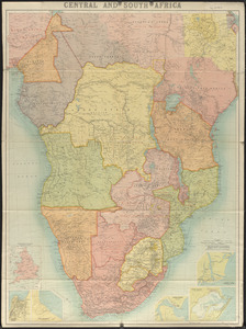
Central and South Africa
42.
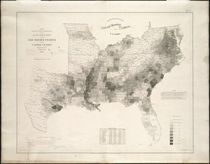
Map showing the distribution of the slave population of the southern states of the United States
43.
Map of North America showing the two lines of frontier as settled in October and November 1782 respectively by Mr. Oswald, the...
44.
The s.e. coast of the United States and its relation to the British West India colonies
45.
Complete map of the rail roads and water courses in the United States & Canada
46.
New Brunswick, Nova Scotia, Newfoundland, and Prince Edward Id.
47.
A new map of the province of Quebec, : according to the Royal proclamation, of the 7th of October 1763
48.
Sketch map of the British coast showing the relative positions of Liverpool, Beaumaris, Moelfra Bay & Point Lynas (taken from...
49.
Section of a track chart of the world, covering the Behring Sea
50.
Washington Sound and approaches, Washington Territory, 1866
51.
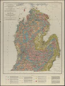
Map of the surface formations of the southern peninsula of Michigan
52.
Athens
53.
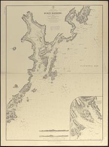
N. America--east coast, Newfoundland--south coast, Burin Harbors
54.
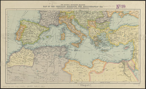
The National Geographic magazine map of the countries bordering the Mediterranean Sea
55.
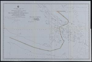
North America--west coast, Strait of Juan de Fuca and the channels between the continent & Vancouver Id. showing the boundary...
56.
Plan of Boston
57.
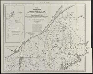
Map of the boundary lines between the United States and the adjacent British provinces from the mouth of the River St. Croix to...
58.
South Italy
59.
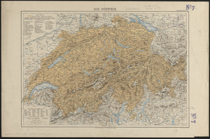
Die Schweiz
60.
Map of Italy and Switzerland
‹ Prev
Next ›
1
2
3
4
5
6
7
8
9