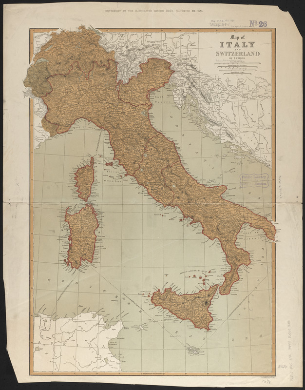
Map of Italy and Switzerland
Item Information
- Title:
- Map of Italy and Switzerland
- Cartographer:
- Ettling, Theodor, 1823-
- Name on Item:
-
by T. Ettling
- Date:
-
1860
- Format:
-
Maps/Atlases
- Location:
-
Boston Public Library
Norman B. Leventhal Map & Education Center - Collection (local):
-
Norman B. Leventhal Map & Education Center Collection
- Subjects:
-
Switzerland--Maps
Italy--Maps
- Places:
-
Switzerland
Italy
- Extent:
- 1 map : color ; 68 x 50 cm
- Terms of Use:
-
No known copyright restrictions.
No known restrictions on use.
- Publisher:
-
[London] :
T. Ettling
- Scale:
-
Scale approximately 1:2,100,000
- Language:
-
English
- Notes:
-
Relief shown by hachures.
Shows state boundaries, rivers, towns, roads and submarine cables.
"Supplement to the Illustrated London News September 22, 1860."
- Identifier:
-
06_01_013996
- Call #:
-
G6710 1860 .E88
- Barcode:
-
39999065698316