Toggle navigation
LMEC Home
Exhibitions
Georeferencing
Tools for Teachers
Collections
My Favorites
Sign Up / Log In
Search
Search the map portal
Map Collection
Map Collection
Map Sets
Search
Search
Search for
Search In
All Fields
Creator
Title
Subject
Place
Search All Digital Collections
Advanced Search
934 Results
My Search
Start Over
More Like
commonwealth-oai:d791xf45n
Remove constraint More Like: commonwealth-oai:d791xf45n
Filter your Search
Place
North and Central America
908
United States
647
Canada
205
New York
192
Quebec
111
Pennsylvania
60
New Jersey
54
Nova Scotia
48
more
Place
»
Topic
United States--History--Revolution, 1775-1783--Maps
305
United States--History--French and Indian War, 1754-1763--Maps
149
Saint Lawrence River--Maps
43
Southern States--Maps
29
Newport (R.I.)--Maps
27
New York (State)--Maps
24
Hudson River (N.Y. and N.J.)--Maps
21
Québec (Québec)--Maps
21
more
Topic
»
Date
Date range begin
–
Date range end
Current results range from
1700
to
1978
View distribution
Creator
Rocque, Mary Ann
29
Holland, Samuel, 1728-1801
25
Jefferys, Thomas, -1771
25
Montrésor, John, 1736-1799
25
Bellin, Jacques Nicolas, 1703-1772
24
Clinton, Henry, Sir, 1738?-1795
19
Robert Sayer and John Bennett (Firm)
15
Hills, John, active 1777-1819
13
more
Creator
»
Format
Maps/Atlases
918
Drawings/Illustrations
11
Documents
5
Prints
1
Georeferenced
Yes
5
No
929
Collection
American Revolutionary War-Era Maps
915
William L. Clements Library Collection
909
Norman B. Leventhal Map & Education Center Collection
19
Maps from AAS
4
MacLean Collection Map Library
1
New York Public Library Collection
1
Available to use
No known restrictions
19
Creative Commons license
1
Search Constraints
Sort by relevance
relevance
title
date (asc)
date (desc)
Number of results to display per page
20 per page
10
per page
20
per page
50
per page
100
per page
View results as:
grid view
map view
Search Results
1.
A map of the Indian nations in the southern department, 1766
2.
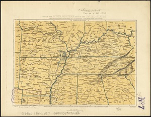
Map of the area between Fort Loudon, Tennessee, and Kaskaskia, Illinois
3.
A general map of the southern British colonies in America comprehending North and South Carolina, Georgia, East and West...
4.
Map of the United States and their territory
5.
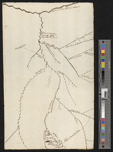
A map of West Florida and part of Et: Florida, Georgia part of So: Carolina i[n]cluding [torn] & Chactaw, Chickasaw & Creek...
6.
Carolinae Floridae nec non insularum Bahamensium : cum partibus adjacendibus delineatio ad Exemplar Londinense in lucem edita a...
7.
Carte de la Louisiane et de la Floride
8.
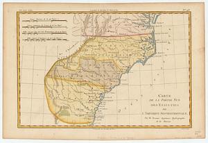
Carte de la partie sud des Etats Unis de l'Amerique Septentrionale
9.
Colton's rail road and county map of the Southern States containing the latest information
10.
The cotton kingdom
11.
Florida from the latest authorities
12.
Johnson's new rail road & county copper plate map of the Southern States from the latest and best information
13.
Lloyd's map of the Southern States, showing all the railroads, their stations & distances : also the counties, towns, villages,...
14.
Lloyd's new military map of the border & southern states
15.
Map fourth division railway mail service
16.
Map of the south western part of the United States : constructed and engraved to illustrate "The War with the South"
17.
Map of the Southern provinces of the United States
18.
Map of the Southern States, showing the relative proportion of slaves in the different localities
19.
Map of Virginia and West Va., North and part of South Carolina, Maryland and Delaware, showing the situation in these states of...
20.
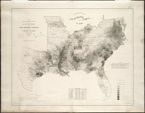
Map showing the distribution of the slave population of the southern states of the United States
‹ Prev
Next ›
1
2
3
4
5
…
46
47


![A map of West Florida and part of Et: Florida, Georgia part of So: Carolina i[n]cluding [torn] & Chactaw, Chickasaw & Creek nations with [torn] [r]oad [torn] Pensacola through ye: Creek nation to Augusitus & Charlestown](https://bpldcassets.blob.core.windows.net/derivatives/metadata/commonwealth-oai:v98001375/image_thumbnail_300.jpg)