Toggle navigation
LMEC Home
Exhibitions
Georeferencing
Tools for Teachers
Collections
My Favorites
Sign Up / Log In
Search
Search the map portal
Map Collection
Map Collection
Map Sets
Search
Search
Search for
Search In
All Fields
Creator
Title
Subject
Place
Search All Digital Collections
Advanced Search
312 Results
My Search
Start Over
More Like
commonwealth:z603vw08p
Remove constraint More Like: commonwealth:z603vw08p
Filter your Search
Place
North and Central America
245
United States
171
Canada
39
New York
31
Suffolk (county)
31
North America
30
Boston
29
Nova Scotia
15
more
Place
»
Topic
North America--Maps--Early works to 1800
21
United States--History--French and Indian War, 1754-1763--Maps--Early works to 1800
17
Boston (Mass.)--History--Revolution, 1775-1783--Maps--Early works to 1800
16
Cape Breton Island (N.S.)--Maps--Early works to 1800
10
Vues d'optique
10
Gibraltar--History--Siege, 1779-1783--Maps--Early works to 1800
9
New York (N.Y.)--Pictorial works--Early works to 1800
9
United States--Maps--Early works to 1800
9
more
Topic
»
Date
Date range begin
–
Date range end
Current results range from
1697
to
1899
View distribution
Creator
Faden, William, 1749-1836
33
Jefferys, Thomas, -1771
32
Des Barres, Joseph F. W. (Joseph Frederick Wallet), 1722-1824
24
Le Rouge, Georges-Louis
23
Sayer, Robert, 1725-1794
21
Korn, Christoph Heinrich, 1726-1783
11
Raspe, Gabriel Nicolaus, 1712-1785
11
Simcoe, John Graves, 1752-1806
10
more
Creator
»
Format
Maps/Atlases
269
Prints
32
Manuscripts
23
Drawings/Illustrations
9
Books
2
Georeferenced
Yes
12
No
300
Collection
American Revolutionary War-Era Maps
309
Richard H. Brown Revolutionary War Map Collection at Mount Vernon
293
Norman B. Leventhal Map & Education Center Collection
14
Maritime Charts and Atlases
6
Boston and New England Maps
4
MacLean Collection Map Library
2
Urban Maps
2
Library and Archives Canada Collection
1
more
Collection
»
Available to use
Creative Commons license
293
No known restrictions
15
Search Constraints
Sort by relevance
relevance
title
date (asc)
date (desc)
Number of results to display per page
20 per page
10
per page
20
per page
50
per page
100
per page
View results as:
grid view
map view
Search Results
1.
Carte topographique du port et de la ville de Louisbourg, assiegé par les Anglais pendant les mois de Juin, Juillet 1758
2.
Plan du fort et ville de Louisbourg dans l'Isle Roale
3.
Plan du port et de la ville de Louisbourg en l'Isle Royale, et des attaques faites par les Anglois pendant le siége dépuis le...
4.
A general map of North America : in which is express'd the several new roads, forts, engagements, &c, taken from actual surveys...
5.
A map of the country between Will's Creek & Monongahela River shewing the rout and encampments of the English army in 1755
6.
A new and accurate map of the English empire in North America : representing their rightful claim as confirmed by charters, and...
7.
A plan of the field of battle and disposition of the troops, as they were on the march at the time of the attack on the 9th of...
8.
Theodolite's pattern, shewing the provinces in North America which were in the respective possessions of England, France &...
9.
A chart of Cape Breton and St. John's Islands &c. in the gulph of St. Lawrence
10.
A chart of the island of Cape Breton
11.
A chart of the N.E. coast of Cape Breton Island, from St. Ann Bay to Cape Morien
12.
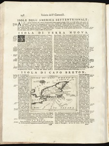
Isola di Capo Breton
13.
Map of Nova Scotia, or Acadia : with the islands of Cape Breton and St. John's, from actual surveys
14.
Plan du port et de la ville de Louisbourg : avec ses batteries et sa perspective, où est réprésenté les batteries faites...
15.
A plan of the city & harbour of Louisburg : shewing that part of Gabarus Bay in which the English landed, also their encampment...
16.
Plan of the siege of Louisbourg in 1758, carry'd on by the British army commanded by His Excellency Major General Amherst, and...
17.
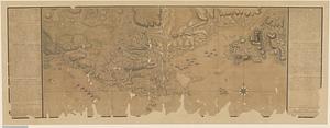
[Sketch of the region of the island of Cape Breton, between the parallels of forty-five and forty-eight degrees of latitude]
18.
The south east coast of Cape Breton Island
19.
An accurate map of His Majesty's province of New Hampshire in New England, taken from actual surveys of all the inhabited part,...
20.
A correct plan of the environs of Quebec, and of the battle fought on the 13th September, 1759 : together with a particular...
‹ Prev
Next ›
1
2
3
4
5
…
15
16


![[Sketch of the region of the island of Cape Breton, between the parallels of forty-five and forty-eight degrees of latitude]](https://bpldcassets.blob.core.windows.net/derivatives/images/commonwealth:4m90fh38k/image_thumbnail_300.jpg)


