Toggle navigation
LMEC Home
Exhibitions
Georeferencing
Tools for Teachers
Collections
My Favorites
Sign Up / Log In
Search
Search the map portal
Map Collection
Map Collection
Map Sets
Search
Search
Search for
Search In
All Fields
Creator
Title
Subject
Place
Search All Digital Collections
Advanced Search
494 Results
My Search
Start Over
More Like
commonwealth:z603vv06x
Remove constraint More Like: commonwealth:z603vv06x
Filter your Search
Place
North and Central America
263
United States
178
North America
176
South America
49
Canada
43
New York
34
Suffolk (county)
31
Boston
29
more
Place
»
Topic
North America--Maps--Early works to 1800
180
South America--Maps--Early works to 1800
46
United States--Maps--Early works to 1800
20
Boston (Mass.)--History--Revolution, 1775-1783--Maps--Early works to 1800
16
Great Britain--Colonies--America--Maps--Early works to 1800
15
Canada--Maps--Early works to 1800
14
New England--Maps--Early works to 1800
11
United States--History--French and Indian War, 1754-1763--Maps--Early works to 1800
11
more
Topic
»
Date
Date range begin
–
Date range end
Current results range from
1528
to
1850
View distribution
Creator
Jefferys, Thomas, -1771
40
Faden, William, 1749-1836
34
Sayer, Robert, 1725-1794
29
Le Rouge, Georges-Louis
24
Des Barres, Joseph F. W. (Joseph Frederick Wallet), 1722-1824
21
Moll, Herman, d. 1732
18
Mitchell, John, 1711-1768
14
Korn, Christoph Heinrich, 1726-1783
11
more
Creator
»
Format
Maps/Atlases
451
Prints
32
Manuscripts
25
Drawings/Illustrations
9
Books
2
Georeferenced
Yes
17
No
477
Collection
American Revolutionary War-Era Maps
392
Richard H. Brown Revolutionary War Map Collection at Mount Vernon
293
Norman B. Leventhal Map Center Collection
150
New York Public Library Collection
32
Mapping Boston Collection
9
Sidney R. Knafel Map Collection at Phillips Academy
8
Boston and New England Maps
6
Maritime Charts and Atlases
4
more
Collection
»
Available to use
Creative Commons license
339
No known restrictions
144
Search Constraints
Sort by relevance
relevance
title
date (asc)
date (desc)
Number of results to display per page
50 per page
10
per page
20
per page
50
per page
100
per page
View results as:
grid view
map view
Search Results
101.
Carte de la Nouuelle France, augmentée depuis la derniere, seruant a la navigation faicte en son vray Meridien
102.
Carte de la Nouuelle France et de la Louisiane nouuellement découuerte : dediée au Roy l'an 1683
103.
Carte de l'Amérique septentrionale, 1754
104.
Carte de l'Amérique septentrionale, depuis la baye d'Hudson jusqu'au Mississipi : pour servir aux essais historiques et...
105.
Carte des possessions angloises & françoises du continent de l'Amérique septentrionale = Kaart van de Engelsche en Fransche...
106.
Carte des possessions des Anglois en Amerique, par rapport à leurs differends avec la France
107.
Carte detaillée des possessions angloises dans l'Amerique Septentrionale : construite d'après les dernieres relations et les...
108.
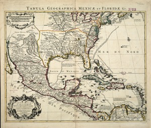
Carte du Mexique et de la Florida : des terres angloises et des Isles Antilles, du cours et des environs de la Riviere de...
109.
Carte d'un partie de l'Amerique Septentrionale : ou est tracée notre route d'Halifax à New York, par Quebec, Montreal, le Lac...
110.
Carte d'une partie de l'Amérique Septentrionale
111.
Carte d'une partie de l'Amérique Septentrionale pour servir à l'intelligence du mémoire sur les prétentions des Anglois au...
112.
Carte générale de l'Amérique séptentrionale : avec les posséssions Angloises dans cette partie du nouveau monde
113.
Carte générale du Canada, de la Louisiane, de la Floride, de la Caroline, de la Virginie, de la Nouvelle Angleterre etc
114.
Carte geographique de la Nouvelle Franse
115.
Carte nouvelle de l'Amérique Angloise contenant tout ce que les Anglois possédent sur le continent de l'Amérique...
116.
Chart of the Atlantic Ocean, with the British, French, & Spanish settlements in North America, and the West Indies : as also on...
117.
Chart of the Atlantic Ocean, with the British, French, & Spanish settlements in North America, and the West Indies : as also on...
118.
Le Colonie Unite dell' America Settentr'le di nuova projezione a ss. ee. li signori riformatori dello studio di Padova : con...
119.
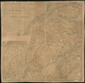
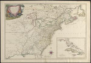
Copy of a map presented to the Congres [sic]
120.
Domina Anglorum in America Septentrionali specialibus mappis Londini primum a Mollio edita, nunc recusa ab Homannianis Hered =...
121.
The English empire in America, Newfound-land, Canada, Hudsons Bay, &c. in plano
122.
The English Empire in America, Newfound-land, Canada, Hudsons Bay &c. in plano
123.
An exact map of North America : from the best authorities
124.
Extract from a map of the British and French dominions in North America
125.
A general map of North America : in which is express'd the several new roads, forts, engagements, &c, taken from actual surveys...
126.
A general map of the middle British colonies in America : Viz. Virginia, Maryland, Delaware, Pensilvania, New-Jersey, New-York,...
127.
Generalkarte von Nord America samt den Westindischen inseln
128.
The isle of California : New Mexico : Louisiane : The river Misisipi, and the lakes of Canada
129.
A map of Louisiana and of the River Mississipi
130.
A map of New England, and Nova Scotia : with part of New York, Canada, and New Britain & the adjacent islands of New Found...
131.
A map of North America, & the West India Islands, with part of South America, Europe, Africa & the Atlantic Ocean with it's...
132.
A map of North America, with the European settlements & whatever else is remarkable in ye West Indies, from the latest and best...
133.
A map of the British and French dominions in North America : with the roads, distances, limits, and extent of the settlements
134.
A map of the British and French dominions in North America : with the roads, distances, limits, and extent of the settlements,...
135.
A map of the British and French dominions in North America : with the roads, distances, limits, and extent of the settlements,...
136.
A map of the British and French dominions in North America : with the roads, distances, limits, and extent of the settlements,...
137.
A map of the British and French dominions in North America, with the roads, distances, limits, and extent of the settlements
138.
A map of the British and French dominions in North America with the roads, distances, limits, and extent of the settlements,...
139.
A Map of the British and French settlements in North America : (part the second) containing part of New York, Pensilvania, New...
140.
A Map of the British and French settlements in North America
141.
A Map of the British and French settlements in North America
142.
A map of the British and French settlements in North America
143.
A map of the British colonies in North America : with the roads, distances, limits, and extent of the settlements, humbly...
144.
A MAP of the BRITISH COLONIES in North America : WITH THE Roads, Distances, Limits, and Extent of the SETTLEMENTS, Humbly...
145.
A map of the British colonies in North America : with the roads, distances, limits, and extent of the settlements, humbly...
146.
A map of the British Empire in America with the French and Spanish settlements adjacent thereto
147.
A map of the British Empire in America with the French and Spanish settlements adjacent thereto
148.
A map of the discoveries made by the Russians on the North West coast of America
149.
A map of the n.e. part of Asia, and n.w. parts of America, shewing their situations with respect to Japan
150.
A map of the northern and middle states : comprehending the western territory & the British dominions in North America : from...
‹ Prev
Next ›
1
2
3
4
5
6
7
…
9
10


![Copy of a map presented to the Congres [sic]](https://bpldcassets.blob.core.windows.net/derivatives/images/commonwealth:z603vn16x/image_thumbnail_300.jpg)