Toggle navigation
LMEC Home
Exhibitions
Georeferencing
Tools for Teachers
Collections
My Favorites
Sign Up / Log In
Search
Search the map portal
Map Collection
Map Collection
Map Sets
Search
Search
Search for
Search In
All Fields
Creator
Title
Subject
Place
Search All Digital Collections
Advanced Search
151 Results
My Search
Start Over
More Like
commonwealth:rx918q84f
Remove constraint More Like: commonwealth:rx918q84f
Filter your Search
Place
North and Central America
140
United States
136
Massachusetts
116
Middlesex (county)
17
Bristol (county)
9
Plymouth (county)
8
Suffolk (county)
7
Barnstable (county)
6
more
Place
»
Topic
Massachusetts--Maps
27
Land use--Massachusetts--Maps
11
Coasts--Massachusetts--Maps
5
Dedham (Mass.)--Maps
4
Election districts--Massachusetts--Maps
4
Massachusetts--Administrative and political divisions--Election districts--Maps
4
Massachusetts--Photomaps--Indexes
4
Newton (Mass.)--Maps
4
more
Topic
»
Date
Date range begin
–
Date range end
Current results range from
1940
to
2010
View distribution
Creator
Applied Geographics, Inc.
61
MassGIS (Office : Mass.)
59
Massachusetts. Executive Office of Environmental Affairs
35
Massachusetts Coastal Zone Management Office
10
Geological Survey (U.S.)
9
Massachusetts Bays Program
8
National Ocean Survey
6
Massachusetts. Department of Environmental Protection
5
more
Creator
»
Format
Maps/Atlases
150
Ephemera
1
Georeferenced
No
151
Collection
Norman B. Leventhal Map & Education Center Collection
150
Applied Geographics, Inc. Records
143
Boston and New England Maps
124
Urban Maps
28
Maritime Charts and Atlases
17
David Judkins Weaver Papers
7
Boston Redevelopment Authority Collection
1
Available to use
No known restrictions
151
Search Constraints
Sort by relevance
relevance
title
date (asc)
date (desc)
Number of results to display per page
20 per page
10
per page
20
per page
50
per page
100
per page
View results as:
grid view
map view
Search Results
1.
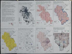
GIS mapping of risk factors for eastern equine encephalitis
2.
Massachusetts Bays Program community resource atlas
3.
Massachusetts watersheds land use
4.
EOEA MassGIS geographic information system transition document : The EOEA geographic information system: MassGIS
5.
Massachusetts coastal zone management program : volume 1, summary map
6.
Massachusetts land use - 1985
7.
Massachusetts land use - 1985
8.
Massachusetts outdoor recreation plan 1966 : public outdoor recreation areas
9.
Metacomet-Monadnock Trail : an analysis of landuse
10.
Twenty years of change on the Massachusetts coastline : maps and statistics, 1951-1971
11.
VOC contamination and public water supplies in the commonwealth of Massachusetts
12.
1985 land use in the Mass. Turnpike corridor
13.
Agriculture and wellhead protection in the Connecticut Valley
14.
Appalachian region, as designated by the Appalachian Regional Commission 1967
15.
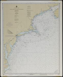
Atlantic coast, Cape Sable to Cape Hatteras
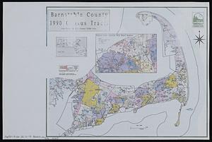
16.
Barnstable County 1990 census tracts
17.
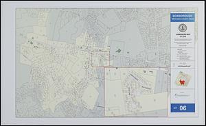
Boxborough, Middlesex County, Mass map 06
18.
[Buildout analysis] New Bedford, Massachusetts
19.
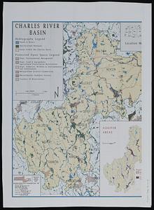
The Charles River basin
20.
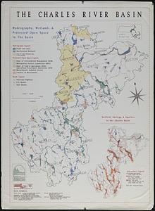
The Charles River basin : hydrography, wetlands & protected open space in the basin
‹ Prev
Next ›
1
2
3
4
5
…
7
8


![[Buildout analysis] New Bedford, Massachusetts](https://bpldcassets.blob.core.windows.net/derivatives/images/commonwealth:v405z947d/image_thumbnail_300.jpg)