1985 land use in the Mass. Turnpike corridor

Item Information
- Title:
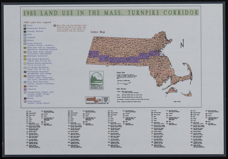
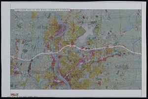
- 1985 land use in the Mass. Turnpike corridor
- Cartographer:
- MassGIS (Office : Mass.)
- Contributor:
- Massachusetts. Executive Office of Environmental Affairs
- Name on Item:
-
MassGIS
- Date:
-
1985
- Format:
-
Maps/Atlases
- Location:
-
Boston Public Library
Norman B. Leventhal Map & Education Center - Collection (local):
-
Applied Geographics, Inc. Records
- Subjects:
-
Massachusetts Turnpike (Mass.)--Maps
Land cover--Massachusetts--Massachusetts Turnpike--Maps
Land use--Massachusetts--Massachusetts Turnpike--Maps
- Places:
-
Massachusetts
- Extent:
- 1 map on 7 sheets : color ; sheets 28 x 42 cm + index map (color ; sheet 28 x 42 cm)
- Terms of Use:
-
No known copyright restrictions.
No known restrictions on use.
- Publisher:
-
Massachusetts :
MassGIS
- Scale:
-
Scale not determined
- Language:
-
English
- Notes:
-
Boston Public Library holds index map and Chicopee sheet only.
- Identifier:
-
06_01_019041
- Call #:
-
AppGeo Folder 30 no. 3-4
- Barcode:
-
30000008063573