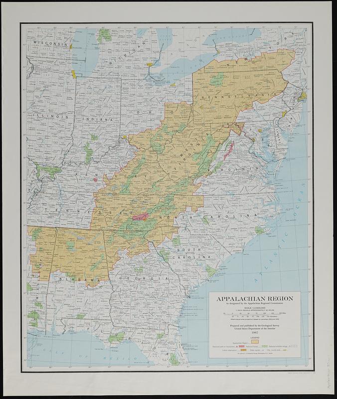
Appalachian region, as designated by the Appalachian Regional Commission 1967
Item Information
- Title:
- Appalachian region, as designated by the Appalachian Regional Commission 1967
- Cartographer:
- Geological Survey (U.S.)
- Name on Item:
-
prepared and published by the Geological Survey, United States Department of the Interior
- Date:
-
1972
- Format:
-
Maps/Atlases
- Location:
-
Boston Public Library
Norman B. Leventhal Map & Education Center - Collection (local):
-
Applied Geographics, Inc. Records
- Subjects:
-
Appalachian Region--Maps
Public lands--Appalachian Region--Maps
National monuments--Appalachian Region--Maps
Indian reservations--Appalachian Region--Maps
- Places:
-
Appalachian Mountains (area)
- Extent:
- 1 map : color ; 67 x 56 cm
- Terms of Use:
-
No known copyright restrictions.
No known restrictions on use.
- Publisher:
-
Washington, D.C. :
Interior--Geological Survey
- Scale:
-
Scale 1:2,500,000. 1 inch equals approximately 40 miles
- Projection:
- Albers equal-area projection based on parallels 29 1/2° and 45 1/2°
- Language:
-
English
- Notes:
-
Also indicates types of federal lands and reserves.
- Identifier:
-
06_01_019113
- Call #:
-
AppGeo Folder 37 no.1