Toggle navigation
LMEC Home
Exhibitions
Georeferencing
Tools for Teachers
Collections
My Favorites
Sign Up / Log In
Search
Search the map portal
Map Collection
Map Collection
Map Sets
Search
Search
Search for
Search In
All Fields
Creator
Title
Subject
Place
Search All Digital Collections
Advanced Search
99 Results
My Search
Start Over
More Like
commonwealth:q524n613d
Remove constraint More Like: commonwealth:q524n613d
Filter your Search
Place
World
80
North and Central America
14
United States
9
Adams (county)
7
Gettysburg National Military Park
6
Pennsylvania
3
New England
2
Arizona
1
more
Place
»
Topic
World maps
82
Pictorial maps
8
Manuscript maps
6
Population--Maps
5
Map projection
4
Telegraph lines--Maps
4
Gettysburg (Pa.)--Maps
3
Gettysburg, Battle of, Gettysburg, Pa., 1863
3
more
Topic
»
Date
Date range begin
–
Date range end
Current results range from
1482
to
2022
View distribution
Creator
Chase, Ernest Dudley, 1878-
7
Bachelder, John B. (John Badger), 1825-1894
4
ODT, Inc
4
Bien, Julius, 1826-1909
3
Brady, Mathew B., approximately 1823-1896
3
Endicott & Co. (New York, N.Y.)
3
Neumann, Louis E.
3
Carey, Mathew, 1760-1839
2
more
Creator
»
Format
Maps/Atlases
94
Manuscripts
8
Photographs
3
Books
1
Documents
1
Georeferenced
Yes
3
No
96
Collection
Norman B. Leventhal Map Center Collection
97
American Revolutionary War-Era Maps
5
Sidney R. Knafel Map Collection at Phillips Academy
2
Boston and New England Maps
1
Urban Maps
1
Available to use
No known restrictions
85
Creative Commons license
4
Search Constraints
Sort by date (desc)
relevance
title
date (asc)
date (desc)
Number of results to display per page
50 per page
10
per page
20
per page
50
per page
100
per page
View results as:
grid view
map view
Search Results
1.
A shared problem, an unequal burden : causes & consequences of climate change
2.
Peters World map
3.
The population map
4.
The world turned upside down
5.
The world's most populous countries
6.
What's up? South! : world map
7.
Political map of the world, April 2001
8.
A pictorial stamp map of navigation and exploration
9.
World freedom : a factual & pictorial map
10.
The pictorial map, a world of stamps
11.
Eight views of the world
12.
Mercator map of the world united : a pictorial history of transport and communications and paths to permanent peace
13.
Peace map of the world united : a pictorial history of transportation and communications from Jonah to the jet plane as paths...
14.
The story map of flying : being a chronicle of man's conquest of the air
15.
Great circle airways
16.
Invasion and total war victory maps : with decorations, illustrations and military and naval insignia
17.
Newsmap : week of October 14 to October 21, 215th week of the war, 97th week of U.S. participation. Monday, October 25, 1943
18.
Total war battle map
19.
The world according to Standard (N.J.)
20.
World wonders : a pictorial map
21.
Carriers of the new black plague
22.
Europe in search of new routes to India and China, 1486-1616 A.D.
23.
Racing routes of the Yankee clippers
24.
Mercator map of the world
25.
The new map of the world
26.
New correct map of the flat surface, stationary earth
27.
Airways of the world on Mercator's projection
28.
The new Europe and the new world
29.
The official map of the world : showing the four quarters of the globe on the quarter-spherical or orange peel projection
30.
Diagram to illustrate contrast between British and Chinese Empires
31.
Map of the world on Mercator's projection, to show the populations and actual areas occupied by the various states represented...
32.
Bartholomew's chart of the world on Mercator's projection
33.
Spherical projection world
34.
Map no. 245
35.
Index diagram of sheets for the International map on the scale of 1:1,000,000
36.
The world upon globular projection and with a gazetteer of information
37.
Map of the world
38.
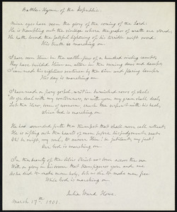
Battle hymn of the republic
39.
The world with all the modern discoveries
40.
Kaufmännische wandkarte der erde zur übersicht der handelsbeziehungen, dampfer- und kabel-verbindungen des Deutschen Reiches...
41.
Stanford's library map of the world on Mercator's projection
42.
Chart of the world showing area in the Pacific Ocean having Hawaii as the only base of supplies in transpacific voyages and...
43.
Caerte van de voornaemste reysen ende ontdeckingen door de Hollanders gedaen, alsook vande landen, plaetsen ende factoriën in...
44.
American Radiator Company trade card
45.
Gleason's new standard map of the world : on the projection of J. S. Christopher, Modern College, Blackheath, England ;...
46.
[Carte marine de la mer Baltique, de la mer du Nord, de l'océan Atlantique Est, de la mer Méditerranée, de la mer Noire et...
47.
Submarine cable chart of the world : showing also the seacoast stations and the principal connecting land lines ; for the use...
48.
Imperial Federation, map of the world showing the extent of the British Empire in 1886
49.
Magnetic variation chart for the year 1882
50.
Diqiu quan tu
‹ Prev
Next ›
1
2


![[Carte marine de la mer Baltique, de la mer du Nord, de l'océan Atlantique Est, de la mer Méditerranée, de la mer Noire et de la mer Rouge]](https://bpldcassets.blob.core.windows.net/derivatives/images/commonwealth:4m90fm28z/image_thumbnail_300.jpg)


