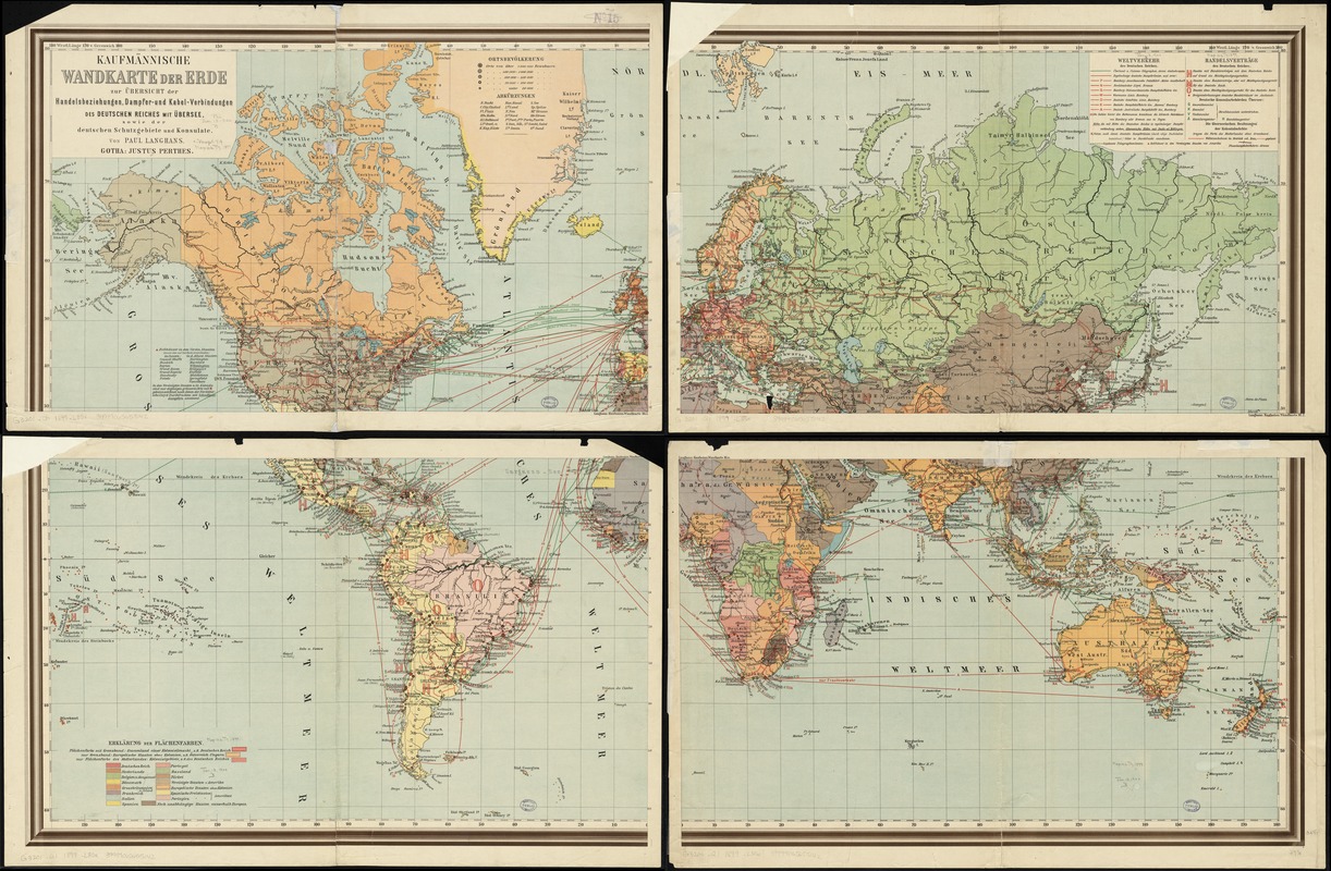
Kaufmännische wandkarte der erde zur übersicht der handelsbeziehungen, dampfer- und kabel-verbindungen des Deutschen Reiches mit übersee, sowie der Deutschen schutzgebiete und konsulate
Item Information
- Title:
- Kaufmännische wandkarte der erde zur übersicht der handelsbeziehungen, dampfer- und kabel-verbindungen des Deutschen Reiches mit übersee, sowie der Deutschen schutzgebiete und konsulate
- Creator:
- Langhans, Paul, 1867-1952
- Name on Item:
-
von Paul Langhans.
- Date:
-
[1899]
- Format:
-
Maps/Atlases
- Location:
-
Boston Public Library
Norman B. Leventhal Map & Education Center - Collection (local):
-
Norman B. Leventhal Map & Education Center Collection
- Subjects:
-
World maps
Transportation--Maps
Telecommunication cables--Maps
Trade routes--Maps
Germany--Commerce--Maps
- Places:
-
Germany
World
- Extent:
- 1 map on 4 sheets : col. ; 89 x 146 cm.
- Terms of Use:
-
No known copyright restrictions.
No known restrictions on use.
- Publisher:
-
Gotha :
Justus Perthes
- Scale:
-
Scale [ca. 1:28,000,000]
- Language:
-
German
- Notes:
-
Shows transportation routes and telecommunication cables.
In German.
- Notes (date):
-
This date is inferred.
- Identifier:
-
06_01_008574
- Call #:
-
G3201.Q1 1899 .L35x
- Barcode:
-
39999065655142