Index diagram of sheets for the International map on the scale of 1:1,000,000
Item Information
- Title:
- Index diagram of sheets for the International map on the scale of 1:1,000,000
- Description:
-
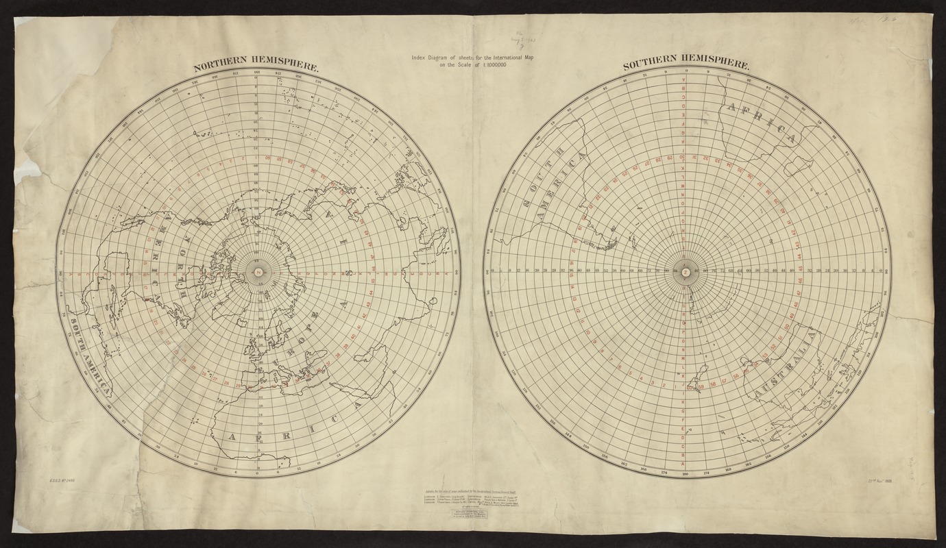
Ushering in an era of international co-operation at the beginning of the 20th century, the world's major countries joined together to create a comprehensive and uniform series of topographic map sheets for the entire world. The participating countries agreed that the proposed series would use standardized map symbols, including hypsometric tints (a gradation of assigned colors) to show elevations. Each map sheet, corresponding to four degrees of latitude and six degrees of longitude, would have a scale of 1:1,000,000 (or 1 inch equals 15.78 miles). Subsequently, the map series was known as the International Map of the World (IMW) or the Millionth Map. Most standard-sized world maps (two by three feet) have a scale in the range of 1:50,000,000 (one inch equals 800 miles). These small-scale maps depict the entire world but show a limited amount of detail. The intended purpose of the international series was to provide a general planning map for the entire world at a larger scale with the capability of showing greater detail. However, to provide geographic coverage of the entire world at a scale of 1:1,000,000 required more than 2,000 map sheets (each measuring approximately 1.5 by 2 feet). If placed adjacent to each other on a sphere, the resulting globe would have a diameter of 42 feet.||Unfortunately, the IMW has had a sporadic history. Following initial discussions about map specifications at an international geographical congress in London in 1909, the project officially began in 1913. Less than a dozen sheets were completed by the beginning of World War I with another 400 completed during the 1930s. During World War II, little progress was made on this project, but following the war, the United Nations assumed supervision of this co-operative venture. By the time this project came to an end in the 1980s, only about 1,000 sheets were completed. Displayed here is an example of the index map for the entire series published in 1909 when initial guidelines for the project were being developed.
- Creator:
- Great Britain. Ordnance Survey
- Name on Item:
-
Great Britain Ordnance Survey.
- Date:
-
1909
- Format:
-
Maps/Atlases
- Location:
-
Boston Public Library
Norman B. Leventhal Map & Education Center - Collection (local):
-
Norman B. Leventhal Map & Education Center Collection
- Subjects:
-
World maps
- Places:
-
World
- Extent:
- 1 diagram ; 56 x 101 cm.
- Terms of Use:
-
No known copyright restrictions.
No known restrictions on use.
- Publisher:
-
London :
[s.n.]
- Scale:
-
Scale not given.
- Language:
-
English
- Notes:
-
G.S.G.S. No. 2486.
Exhibited in “Journeys of the Imagination,” at the Boston Public Library, Boston, MA, April - August 2006. MB (BRL)
- Identifier:
-
05_01_000236
- Call #:
-
G3200 1909 .G7
- Barcode:
-
39999052507116


