Diagram to illustrate contrast between British and Chinese Empires
Item Information
- Title:
- Diagram to illustrate contrast between British and Chinese Empires
- Editor:
- Curtis, Lionel, 1872-1955
- Date:
-
1917
- Format:
-
Maps/Atlases
- Location:
-
Boston Public Library
Norman B. Leventhal Map & Education Center - Collection (local):
-
Norman B. Leventhal Map & Education Center Collection
- Subjects:
-
World maps
Population--Maps
- Places:
-
World
- Extent:
- 1 map : color ; 22 x 41 cm, on sheet 24 x 60 cm
- Terms of Use:
-
No known copyright restrictions.
No known restrictions on use.
- Publisher:
-
London :
Macmillan and Co., Limited
- Scale:
-
Not drawn to scale
- Language:
-
English
- Notes:
-
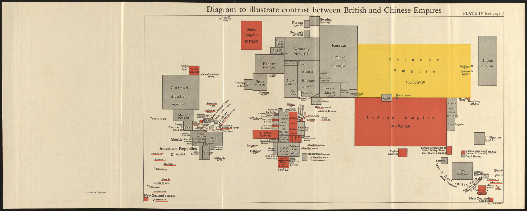
Cartogram showing country sizes based on population.
Areas under the dominion of the British Empire indicated in red.
Appears in The commonwealth of nations / edited by L. Curtis.
"Plate IV (see page I)."
"At end of volume."
- Notes (exhibitions):
-
Exhibited: "Bending lines: maps and data from distortion to deception," organized by the Norman B. Leventhal Map & Education Center at the Boston Public Library, 2020-2021.
- Identifier:
-
06_01_017142
- Call #:
-
JN276 .C917
- Barcode:
-
39999085954236


