Toggle navigation
LMEC Home
Exhibitions
Georeferencing
Tools for Teachers
Collections
My Favorites
Sign Up / Log In
Search
Search the map portal
Map Collection
Map Collection
Map Sets
Search
Search
Search for
Search In
All Fields
Creator
Title
Subject
Place
Search All Digital Collections
Advanced Search
522 Results
My Search
Start Over
More Like
commonwealth:q524mv61t
Remove constraint More Like: commonwealth:q524mv61t
Filter your Search
Place
North and Central America
283
North America
180
United States
180
West Indies
58
Canada
43
New York
34
Suffolk (county)
31
Boston
29
more
Place
»
Topic
North America--Maps--Early works to 1800
180
West Indies--Maps--Early works to 1800
60
United States--Maps--Early works to 1800
21
Caribbean Area--Maps--Early works to 1800
17
Boston (Mass.)--History--Revolution, 1775-1783--Maps--Early works to 1800
16
Great Britain--Colonies--America--Maps--Early works to 1800
15
Atlantic Ocean--Maps--Early works to 1800
14
Canada--Maps--Early works to 1800
14
more
Topic
»
Date
Date range begin
–
Date range end
Current results range from
1525
to
1850
View distribution
Creator
Jefferys, Thomas, -1771
43
Faden, William, 1749-1836
34
Sayer, Robert, 1725-1794
32
Le Rouge, Georges-Louis
24
Des Barres, Joseph F. W. (Joseph Frederick Wallet), 1722-1824
21
Moll, Herman, d. 1732
15
Mitchell, John, 1711-1768
14
Korn, Christoph Heinrich, 1726-1783
11
more
Creator
»
Format
Maps/Atlases
479
Prints
32
Manuscripts
28
Drawings/Illustrations
9
Books
2
Georeferenced
Yes
26
No
496
Collection
American Revolutionary War-Era Maps
416
Richard H. Brown Revolutionary War Map Collection at Mount Vernon
293
Norman B. Leventhal Map Center Collection
173
New York Public Library Collection
32
Maritime Charts and Atlases
16
Sidney R. Knafel Map Collection at Phillips Academy
10
Mapping Boston Collection
9
Boston and New England Maps
6
more
Collection
»
Available to use
Creative Commons license
340
No known restrictions
167
Search Constraints
Sort by relevance
relevance
title
date (asc)
date (desc)
Number of results to display per page
20 per page
10
per page
20
per page
50
per page
100
per page
View results as:
grid view
map view
Search Results
21.
Carte de l'Amérique Septle. pour servir à l'intelligence de la guerre entre les Anglois et les insurgents
22.
Carte des possessions angloises dans l'Amerique Septentrionale pour servir d'intelligence à la guerre presente traduite de...
23.
A general map of North America : in which is express'd the several new roads, forts, engagements, &c, taken from actual surveys...
24.
LʼAmérique Septentrionale et Méridionale divisée suivant ses différens pays
25.
A map of the British and French dominions in North America with the roads, distances, limits, and extent of the settlements,...
26.
A new and correct map of North America, with the West India Islands : divided according to the last Treaty of Peace, concluded...
27.
A new map of North America wherein the British Dominions in the continent of North America : and on the islands of the West...
28.
A new map of the British colonies in North America, shewing the seat of the present war, taken from the best surveys, compared...
29.
North America from the French of Mr. D'Anville, improved with the back settlements of Virginia and course of Ohio, illustrated...
30.
Theodolite's pattern, shewing the provinces in North America which were in the respective possessions of England, France &...
31.
Chart comprizing Greenland with the countries and islands about Baffin's and Hudson's Bays
32.
Chart containing the coasts of California, New Albion, and Russian discoveries to the north : with the peninsula of Kamchatka,...
33.
Chart containing the greater part of the South Sea to the south of the line, with islands dispersed thro' the same
34.
Atlantic Ocean
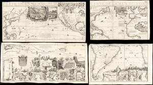
35.
Carte de la Mer du Sud et des costes d'Amerique et d'Asie situées sur cette mer : Carte de la Mer du Nord et des costes...
36.
A chart of the Atlantick Ocean describing the Coast of Africa from Cape Teffalana to Cape Formosa
37.
Mare del Nord
38.
A new chart of the vast Atlantic or Western Ocean including the sea coast of Europe, Africa, America, and the West India...
39.
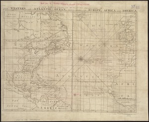
A new map or chart in Mercators projection, of the Western or Atlantic Ocean, with part of Europe, Africa and America
40.
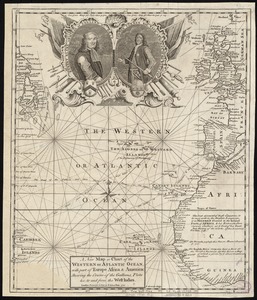
A new map or chart of the Western or Atlantic Ocean, with part of Europe Africa & America : showing the course of galleons,...
‹ Prev
Next ›
1
2
3
4
5
6
…
26
27