Toggle navigation
LMEC Home
Exhibitions
Georeferencing
Tools for Teachers
Collections
My Favorites
Sign Up / Log In
Search
Search the map portal
Map Collection
Map Collection
Map Sets
Search
Search
Search for
Search In
All Fields
Creator
Title
Subject
Place
Search All Digital Collections
Advanced Search
17 Results
My Search
Start Over
More Like
commonwealth:js957751w
Remove constraint More Like: commonwealth:js957751w
Filter your Search
Place
North and Central America
14
United States
11
World
3
Illinois
2
Allegheny (county)
1
Braddock
1
Chicago
1
Cook (county)
1
more
Place
»
Topic
Manuscript maps
3
World maps
3
Indians of North America--Maps
2
Pacific railroads--Explorations and surveys
2
United States Pacific Railroad Expeditions and Surveys
2
Assiniboine Indians--Pictorial works
1
Blast Furnaces--Pennsylvania--Braddock--Maps
1
Braddock (Pa.)--Maps
1
more
Topic
»
Date
Date range begin
–
Date range end
Current results range from
1766
to
1900
View distribution
Creator
Sarony, Major & Knapp Lith.
2
Stanley, John Mix, 1814-1872
2
Beard, Ithamar A., 1789-1871
1
Boynton, George W., -1884
1
Bradford, Robert H.
1
Carnegie Brothers & Company
1
Carpenter, Juliana
1
Ellicott, Andrew, 1754-1820
1
more
Creator
»
Format
Maps/Atlases
14
Manuscripts
3
Prints
3
Georeferenced
Yes
8
No
9
Collection
Norman B. Leventhal Map & Education Center Collection
16
Urban Maps
2
American Revolutionary War-Era Maps
1
Boston and New England Maps
1
William L. Clements Library Collection
1
Available to use
No known restrictions
13
Creative Commons license
3
Search Constraints
Sort by relevance
relevance
title
date (asc)
date (desc)
Number of results to display per page
20 per page
10
per page
20
per page
50
per page
100
per page
View results as:
grid view
map view
Search Results
1.
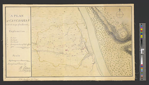
A plan of Cascasquias with the design of an enceinte
2.
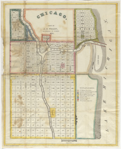
Chicago
3.
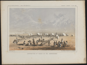
Distribution of goods to the Assiniboines
4.
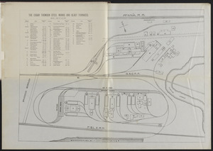
The Edgar Thomson Steel Works and Blast Furnaces
5.
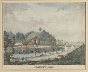
Ellicott's Mills
6.
Map of North America from 20 to 80 degrees north latitude : exhibiting the recent discoveries, geographical and nautical; drawn...
7.
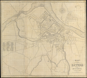
Map of the city of Lowell : surveyed in 1841 by order of the principal authorities
8.
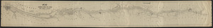
Map of the Hudson River Rail Road from New York to Albany
9.
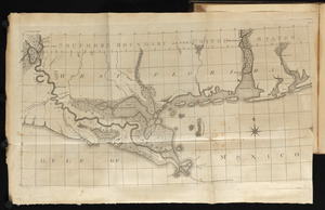
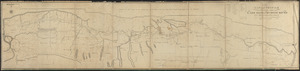
Map of the Lower Mississippi River
10.
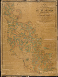
Map of the parishes of Pointe Coupee, West Baton Rouge and Iberville : including parts of the parishes of St. Martins and...
11.
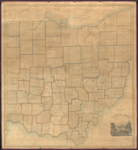
A map of the state of Ohio : from actual survey
12.
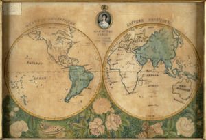
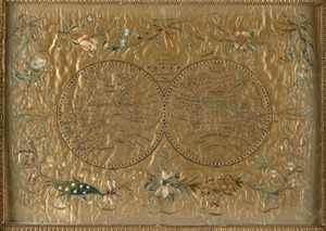
Map of the world
13.
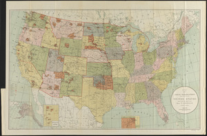
Map showing Indian reservations within the limits of the United States
14.
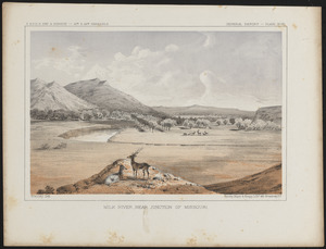
Milk River, near junction of Missouri
15.
A new map and profile of the proposed canal from Lake Erie to Hudson River in the state of New York
16.
The world
17.
The world with all the modern discoveries