Toggle navigation
LMEC Home
Exhibitions
Georeferencing
Tools for Teachers
Collections
My Favorites
Sign Up / Log In
Search
Search the map portal
Map Collection
Map Collection
Map Sets
Search
Search
Search for
Search In
All Fields
Creator
Title
Subject
Place
Search All Digital Collections
Advanced Search
386 Results
My Search
Start Over
More Like
commonwealth:hx11xz487
Remove constraint More Like: commonwealth:hx11xz487
Filter your Search
Place
North and Central America
345
United States
225
Canada
103
Essex (county)
24
Suffolk (county)
24
Boston
22
Louisbourg
21
Saint Lawrence River
19
more
Place
»
Topic
United States--History--French and Indian War, 1754-1763--Maps, Manuscript--Early works to 1800
58
Louisbourg (N.S.)--Maps, Manuscript--Early works to 1800
18
Fort Edward (N.Y.)--Maps, Manuscript--Early works to 1800
16
Fort Ticonderoga (N.Y.)--Maps, Manuscript--Early works to 1800
15
Saint Lawrence River--Maps, Manuscript--Early works to 1800
15
Louisbourg (N.S.)--History--Siege, 1745--Maps, Manuscript--Early works to 1800
14
Fortification--New York (State)--Fort Edward--Maps, Manuscript--Early works to 1800
13
Fortification--New York (State)--Maps, Manuscript--Early works to 1800
13
more
Topic
»
Date
Date range begin
–
Date range end
Current results range from
1664
to
1879
View distribution
Creator
Royal United Services Institute for Defence and Security Studies
160
George, III, King of Great Britain, 1738-1820
152
George, IV, King of Great Britain, 1762-1830
151
Amherst, Jeffery Amherst, Baron, 1717-1797
128
Skinner, Monier
28
Skinner, William, 1700-1780
28
Brasier, William
16
Bastide, John Henry, approximately 1700-1770
15
more
Creator
»
Format
Maps/Atlases
369
Manuscripts
160
Drawings/Illustrations
15
Georeferenced
Yes
8
No
378
Collection
British Library Collection
376
American Revolutionary War-Era Maps
360
Boston and New England Maps
24
Urban Maps
8
Library of Congress Collection
7
Norman B. Leventhal Map Center Collection
3
Maritime Charts and Atlases
2
Available to use
Creative Commons license
383
No known restrictions
3
Search Constraints
Sort by relevance
relevance
title
date (asc)
date (desc)
Number of results to display per page
50 per page
10
per page
20
per page
50
per page
100
per page
View results as:
grid view
map view
Search Results
151.
[Map showing Saint John's Harbour with Fort William and Fort Townshend]
152.
[Map showing the attack of the French upon York in Virginia, June 1782]
153.
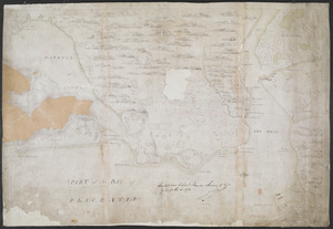
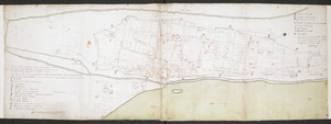
[Map showing the boundary line between the provinces of Massachusetts Bay and Connecticut by Woodward and Saffery in 1642 and...
154.
[Map showing the disposition of General Amhert's boats and rafts]
155.
[Map showing the location of Fort de la Presentation]
156.
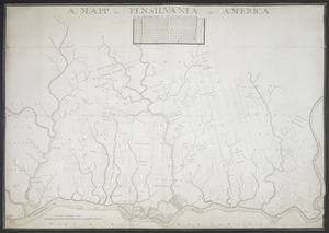
A MAPP OF PENSYLVANIA IN AMERICA
157.
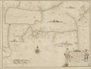
A Mappe of Colonel Römers Voyage to ye: 5 Indian nations going from New Yorck to Albany thence west to ye 3 Macquas Castle and...
158.
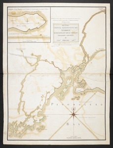
MAY 23. 1759. PROVINCE MASSACHUSETTS BAY PENOBSCOT DOMINIONS OF GREAT BRITAIN POSSESSION CONFIRM'D BY THOS. POWNALL GOVR
159.
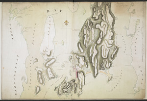
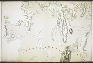
NARRAGANSETT BAY containing Rhode Island &c
160.
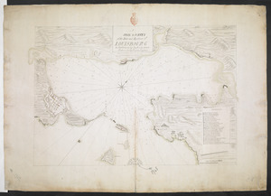
NARRAGANSETT BAY containing Rhode Island &c
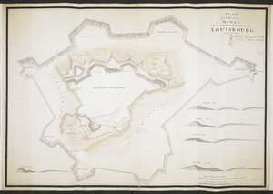
161.
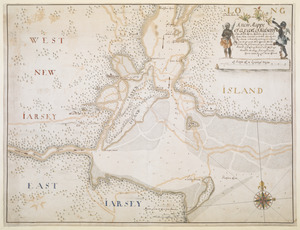
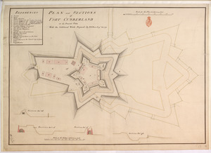
A new Mappe of a part of Hutsons or the North River, Rareton River which have there aiet lett in to the Sea by Sandy hoocke,...
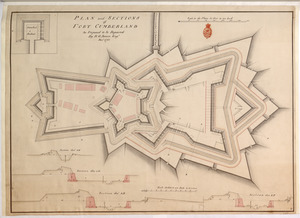
162.
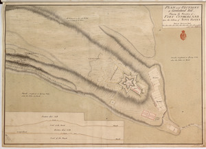
A New Plan of ye Great Town of BOSTON in New England in AMERICA with the many Additionall Buildings & New Streets to the Year,...
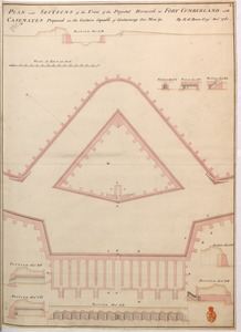
163.
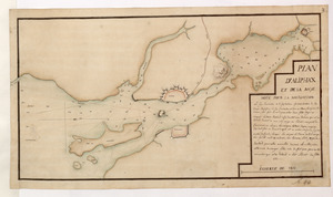
A new plan of ye great town of Boston in New England in America with the many additionall buildings & new streets to the year 1743
164.
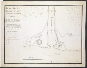
Nouveau plan du Lac ontario depuis Le fort frontenac jusquà Chouayguin, avec les isles Et Bancs qui y Sont
165.
PART OF HUDSON'S RIVER
166.
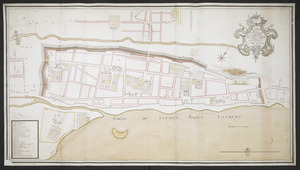
PART of the BAY of PLACENTIA
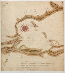
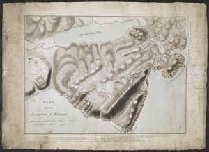
167.
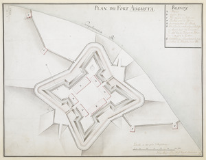
PART OF THE HARBOUR of ST IOHNS
168.
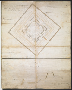
[Part of the Island of Orleans and the Saint Lawrence River]
169.
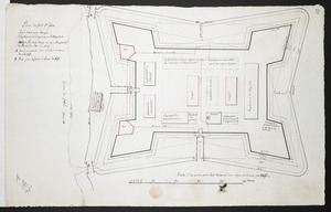
PARTIE DU PLAN DE QUEBEC
170.
PENSACOLA TOWN, FORT, and BARRACK
171.
A PLAN & SURVEY of the Town and Harbour of LOUISBOURG : the harbour by Cap Darell & the Town & Batteries by Cap Bastide Engineer
172.
PLAN and Profil of the MINES for the Demolition of the Fortification of LOUISBOURG completed the 8.th of November 1760
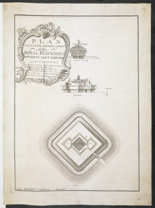
173.
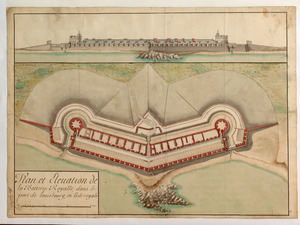
PLAN and SECTIONS of Cumberland Hill Showing the Situation of FORT CUMBERLAND Upon the Isthmus of NOVA SCOTIA
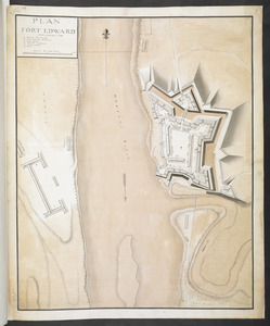
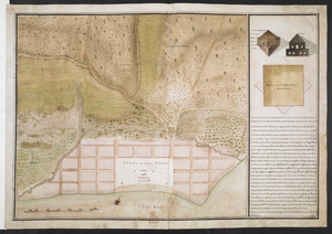
174.
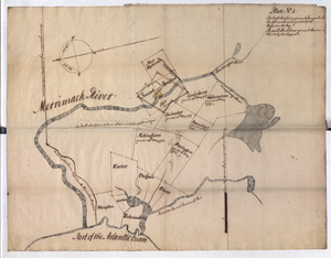
PLAN and SECTIONS of FORT CUMBERLAND As Proposed to be Repaired
175.
PLAN and SECTIONS of FORT CUMBERLAND in its Present State With the Additional Works Proposed
176.
PLAN and SECTIONS of the Front of the Projected Hornwork at FORT CUMBERLAND with CASEMATES Proposed in the Curtain Capable of...
177.
PLAN D'ALIPHAX ET DE LA BAYE
178.
[PLAN de Carillon]
179.
PLAN DE LA RIVIERE ET DES FORTS DE CHVAGEN
180.
PLAN DE LA VILLE DE MONT REAL DEDIER A SON EXCELLENCE M.R LE GENERAL AMHERST COMMANDANT EN CHEF LES FORCES DE SA MAJESTE...
181.
Plan de la ville de Montreal en Canada levé en l'annee 1713
182.
Plan de la ville de Montreal en Canada levé en l'année 1713 et enceinte a Este rectifiée
183.
PLAN DE L'INTENDANCE DE QUE'BEC : Cette Maison Sert aussi de Palais; Elle est Située hors de la Ville, dans le Faubourg de...
184.
[Plan de Louisburgh, et partie de la baye de Gabarus]
185.
PLAN DU FORT AUGUSTA
186.
Plan du fort de Chouéghen de la Riviere Et de terrain aux Environs au Sud du Lac Ontario
187.
[Plan Du fort Georges appelé par les Anglois William-Henri prie par les francois en 1757 le 9 Aout]
188.
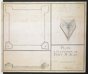
Plan du fort S.t Jean
189.
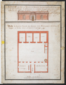
PLAN du Rex de Chausee des Batiments de la Prison, ayant dix Toises de largeur et Treize toises et demi de longeur
190.
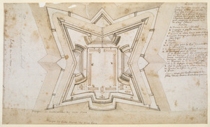
Plan dun Fort convenable en quelque endroit ce que soit dune Cote maritime Auquel on a changé la figure reguliere du 1.r...
191.
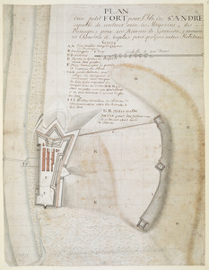
PLAN dun petit FORT pour l'Isle de S.t ANDRE capable de contenir outre les Magazins, des Barraques pour 200 Hommes de Garrison,...
192.
PLAN D'une des Redoutes des Lignes projettee par Mr de PontLeroy ing.r le Chef du Canada sur La plage de Beaupoint pour...
193.
PLAN E L'ELEVATION DU FORT S.T JEAN
194.
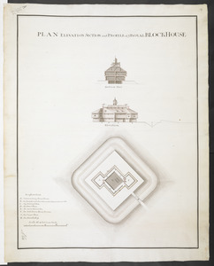
Plan Elevation and sections of Blockhouse to be built at Penobscot in the Bay of Funda to contain 100 Men or more if necessary....
195.
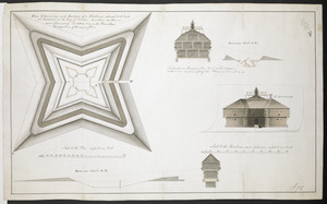
PLAN ELEVATION SECTION and PROFILE of ye ROYAL BLOCKHOUSE
196.
PLAN ELEVATION SECTION and PROFILE of ye ROYAL BLOCKHOUSE OPPOSITE FORT EDWARD
197.
Plan et Elevation de la Batterie Royalle, dans le port de louisbourg, en l'isle royale
198.
PLAN FORT EDWARD
199.
Plan No: 1 : [Eastern New Hampshire and Massachusetts]
200.
Plan No: 2 : [Eastern New Hampshire and Massachusetts]
‹ Prev
Next ›
1
2
3
4
5
6
7
8
![[Map showing Saint John's Harbour with Fort William and Fort Townshend]](https://bpldcassets.blob.core.windows.net/derivatives/images/commonwealth:6108vv278/image_thumbnail_300.jpg)
![[Map showing the attack of the French upon York in Virginia, June 1782]](https://bpldcassets.blob.core.windows.net/derivatives/images/commonwealth:hx11xz51j/image_thumbnail_300.jpg)
![[Map showing the boundary line between the provinces of Massachusetts Bay and Connecticut by Woodward and Saffery in 1642 and as run in 1713]](https://bpldcassets.blob.core.windows.net/derivatives/images/commonwealth:hx11z5641/image_thumbnail_300.jpg)
![[Map showing the disposition of General Amhert's boats and rafts]](https://bpldcassets.blob.core.windows.net/derivatives/images/commonwealth:hx11xz67f/image_thumbnail_300.jpg)
![[Map showing the location of Fort de la Presentation]](https://bpldcassets.blob.core.windows.net/derivatives/images/commonwealth:hx11z0993/image_thumbnail_300.jpg)


![[Part of the Island of Orleans and the Saint Lawrence River]](https://bpldcassets.blob.core.windows.net/derivatives/images/commonwealth:hx11z067t/image_thumbnail_300.jpg)

![[PLAN de Carillon]](https://bpldcassets.blob.core.windows.net/derivatives/images/commonwealth:hx11z1778/image_thumbnail_300.jpg)

![[Plan de Louisburgh, et partie de la baye de Gabarus]](https://bpldcassets.blob.core.windows.net/derivatives/images/commonwealth:hx11z045s/image_thumbnail_300.jpg)
![[Plan Du fort Georges appelé par les Anglois William-Henri prie par les francois en 1757 le 9 Aout]](https://bpldcassets.blob.core.windows.net/derivatives/images/commonwealth:hx11z1913/image_thumbnail_300.jpg)