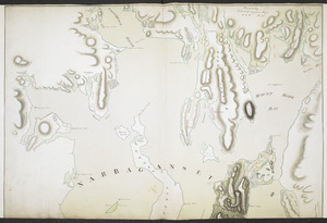
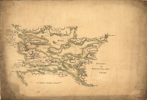
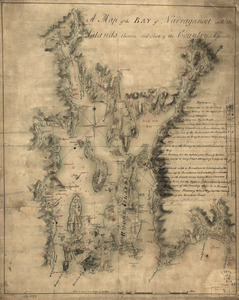
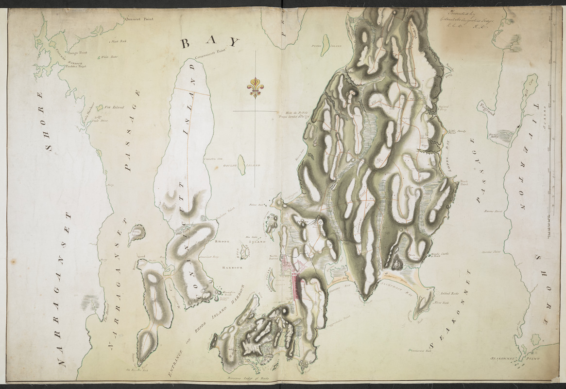
NARRAGANSETT BAY containing Rhode Island &c
This map is also available in American Revolutionary Geographies Online (ARGO), a collections portal especially built for material relating to the American Revolutionary War Era. Visit ARGO to learn more about this item and explore the historical geography of North America in the late eighteenth century.
Item Information
- Title:
- NARRAGANSETT BAY containing Rhode Island &c
- Former owner:
- Royal United Services Institute for Defence and Security Studies
- Date:
-
[1776]
- Format:
-
Maps/Atlases
- Location:
- British Library
- Collection (local):
-
British Library Collection
- Subjects:
-
Fortification--Rhode Island--Narragansett Bay--Maps, Manuscript--Early works to 1800
Military art and science--Rhode Island--Narragansett Bay--Maps, Manuscript--Early works to 1800
Narragansett Bay (R.I.)--Maps, Manuscript--Early works to 1800
- Places:
-
Bristol (county)Narragansett Bay
- Extent:
- 1 map on 2 sheets : manuscript pen and ink with watercolour ; 134 x 97 cm, on sheets 67 x 99 cm
- Terms of Use:
-
No known copyright restrictions.
This work is licensed for use under a Creative Commons Attribution Non-Commercial Share Alike License (CC BY-NC-SA).

- Publisher:
-
[Place of production not identified] :
[producer not identified]
- Scale:
-
Scale approximately 1:24,000
- Language:
-
English
- Catalog Record:
-
http://searcharchives.bl.uk/IAMS_VU2:IAMS040-001999749
- Notes:
-
Date attributed based on information shown on map; "Here the British Troops Landed 8.th Dec.r 1776"
Title from verso
Compare other manuscript maps of Narragansett Bay: the unattributed "[Map of Narragansett Bay]" (Add Ms 57,715.3.), "A map of the bay of Narraganset with the islands therein and part of the country adjacent" held by the Library of Congress (Call Number G3772.N3 1777 .B49) and by Charles Blaskowitz, and "[Narragansett Bay and the surrounding shores]" held by the William L. Clements Library (Maps 3-J-7 / Clinton Maps 58 - see Brun 275) and by Thomas Wheeler
Relief is shown by shading
Shows scale bars at lower in yards and miles
Shows roads
Shows some military fortifications.
Copy at Add Ms 27,716.1-2. Comprises two separate sheets, both laid on linen. Manuscript inscription in black ink at upper right shows "Presented by Colonel Sir Augustus Frazer K.C.B. R.A." - both sheets. Green circular label to verso (both sheets) showing "14". White label to verso showing "DRAWER 30 SECTION 2". Manuscript addition in pencil to verso (both sheets) showing "A 30/91". Titles to verso and additional "Rhode Island". Stamped in black ink "ADD. MS. 57,716(1)" and "ADD. MS. 57,716(2)".
- Notes (date):
-
9999
This date is inferred.

![[Map of Narragansett Bay]](https://bpldcassets.blob.core.windows.net/derivatives/images/commonwealth:hx11z2791/image_thumbnail_300.jpg)