Toggle navigation
LMEC Home
Exhibitions
Georeferencing
Tools for Teachers
Collections
My Favorites
Sign Up / Log In
Search
Search the map portal
Map Collection
Map Collection
Map Sets
Search
Search
Search for
Search In
All Fields
Creator
Title
Subject
Place
Search All Digital Collections
Advanced Search
9049 Results
My Search
Start Over
More Like
commonwealth:gx41q247t
Remove constraint More Like: commonwealth:gx41q247t
Filter your Search
Place
North and Central America
6,280
United States
5,198
Massachusetts
2,150
Suffolk (county)
1,400
Europe
1,396
Boston
1,373
Canada
449
Asia
438
more
Place
»
Topic
Boston (Mass.)--Maps
677
City planning--Massachusetts--Boston--Maps
418
United States--Maps
282
Urban renewal--Massachusetts--Boston--Maps
253
Real property--Massachusetts--Boston--Maps
217
Massachusetts--Maps
162
Landowners--Massachusetts--Boston--Maps
135
North America--Maps--Early works to 1800
103
more
Topic
»
Date
Date range begin
–
Date range end
Current results range from
1482
to
2023
View distribution
Creator
United States. Hydrographic Office
595
Boston Redevelopment Authority
392
O.H. Bailey & Co
148
Des Barres, Joseph F. W. (Joseph Frederick Wallet), 1722-1824
123
United States. Post Office Dept
120
Ptolemy, 2nd cent
100
Walling, Henry Francis, 1825-1888
94
Geological Survey (U.S.)
86
more
Creator
»
Format
Maps/Atlases
8,989
Manuscripts
215
Prints
56
Books
36
Objects/Artifacts
10
Drawings/Illustrations
7
Posters
5
Georeferenced
Yes
869
No
8,180
Collection
Norman B. Leventhal Map & Education Center Collection
8,694
Boston and New England Maps
2,587
Urban Maps
2,375
Maritime Charts and Atlases
1,083
American Revolutionary War-Era Maps
616
Boston Redevelopment Authority Collection
441
Available to use
No known restrictions
8,907
Creative Commons license
47
Search Constraints
Sort by relevance
relevance
title
date (asc)
date (desc)
Number of results to display per page
20 per page
10
per page
20
per page
50
per page
100
per page
View results as:
grid view
map view
Search Results
21.
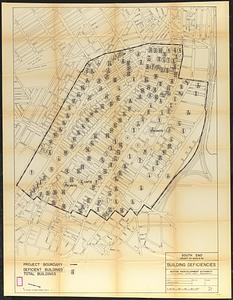
South End project no. Mass. r-56 : building deficiencies
22.
Back Bay park
23.
Plan of the parkway between Muddy River gate house and Jamaica Park 1892
24.
Proposed Charles River Park
25.
Proposed Charles River Park
26.
Rose garden in Fens-Back Bay
27.
Sears Park conceptual site plan with historic waterway
28.
Suggestion for the improvement of Muddy River and for completing a continuous promenade from the Common to Jamaica Pond
29.
Appleton St. Woonerf
30.
Union Park
31.
Berkeley Street community garden
32.
Building deficiencies map : Government Center project no. Mass. R-35
33.
Campus High School urban renewal area Mass. r-129 : property map
34.
Charlestown urban renewal project Boston (Suffolk County) Massachusetts Mass. R-55 : topographic map
35.
Columbia Point development study
36.
Columbia Point updated base maps
37.
Illustrative site plan : Government Center urban renewal area, Massachusetts R-35
38.
Illustrative site plan : Washington Park urban renewal area, Massachusetts R-24
39.
Landscaping plan of City Hall Plaza, Boston
40.
Outline map of Boston
‹ Prev
Next ›
1
2
3
4
5
6
…
452
453