Toggle navigation
LMEC Home
Exhibitions
Georeferencing
Tools for Teachers
Collections
My Favorites
Sign Up / Log In
Search
Search the map portal
Map Collection
Map Collection
Map Sets
Search
Search
Search for
Search In
All Fields
Creator
Title
Subject
Place
Search All Digital Collections
Advanced Search
8560 Results
My Search
Start Over
More Like
commonwealth:cj82p3183
Remove constraint More Like: commonwealth:cj82p3183
Filter your Search
Place
North and Central America
5,855
United States
4,778
Massachusetts
2,053
Europe
1,359
Suffolk (county)
1,034
Boston
1,007
Canada
448
Asia
422
more
Place
»
Topic
Boston (Mass.)--Maps
578
United States--Maps
273
Real property--Massachusetts--Boston--Maps
174
Massachusetts--Maps
161
Landowners--Massachusetts--Boston--Maps
132
North America--Maps--Early works to 1800
103
New England--Maps
99
Europe--Maps
78
more
Topic
»
Date
Date range begin
–
Date range end
Current results range from
1482
to
2023
View distribution
Creator
United States. Hydrographic Office
594
O.H. Bailey & Co
148
Des Barres, Joseph F. W. (Joseph Frederick Wallet), 1722-1824
123
United States. Post Office Dept
120
Ptolemy, 2nd cent
100
Walling, Henry Francis, 1825-1888
94
Geological Survey (U.S.)
87
Jefferys, Thomas, -1771
85
more
Creator
»
Format
Maps/Atlases
8,501
Manuscripts
215
Prints
56
Books
36
Objects/Artifacts
10
Drawings/Illustrations
8
Posters
4
Georeferenced
Yes
869
No
7,691
Collection
Norman B. Leventhal Map & Education Center Collection
8,550
Boston and New England Maps
2,204
Urban Maps
1,935
Maritime Charts and Atlases
1,081
American Revolutionary War-Era Maps
616
Boston Redevelopment Authority Collection
87
Massachusetts Real Estate Atlases
10
David Judkins Weaver Papers
1
Available to use
No known restrictions
8,409
Creative Commons license
46
Search Constraints
Sort by relevance
relevance
title
date (asc)
date (desc)
Number of results to display per page
50 per page
10
per page
20
per page
50
per page
100
per page
View results as:
grid view
map view
Search Results
1.
Richards standard atlas of the city of Lynn and the towns of Swampscott, Saugus, and Nahant, Massachusetts
2.
Atlas of the city of Lynn, Massachusetts : including, also, the towns of Swampscott and Saugus : based upon, and carefully...
3.
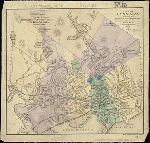
Atlas of the City of Lynn, Massachusetts, including also, the towns of Swampscott and Saugus
4.
Atlas of the City of Lynn, Massachusetts, including also, the towns of Swampscott and Saugus
5.
Atlas of Essex County, Massachusetts
6.
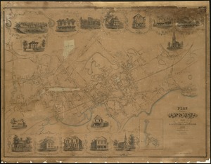
Map of Swampscott, Nahant & Saugus
7.
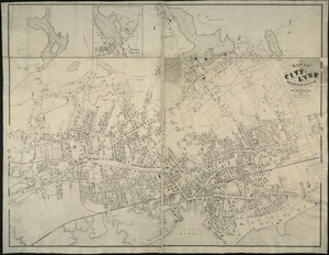
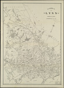
Map of the city of Lynn Massachusetts
8.
Plan of the city of Lynn Mass. from actual surveys
9.
Atlas of the town of Swampscott, Essex County, Mass. : from official plans and actual surveys
10.
Plan of properties at Galloupe's Point : Swampscott, Mass.
11.
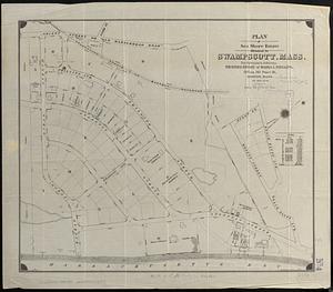
Plan of Sea Shore Estate situated in Swampscott, Mass.
12.
Atlas of the town of Nahant, Essex County, Mass.
13.
Atlas of the town of Nahant, Massachusetts
14.
Town of Nahant
15.
City atlas of Lynn, Massachusetts : from official records, private plans and actual surveys
16.
Atlas of the town of Swampscott, Essex County, Mass. : from official plans and actual surveys
17.
Atlas of the town of Swampscott, Massachusetts
18.
Map of Lynn and Saugus : settled in 1629
19.
City of Lynn, Mass
20.
City of Lynn, Mass
21.
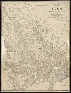
Map of the city of Lynn
22.
Ten miles around Lynn
23.
Land use shading test plot shadeset PI and lu21-pi.lut
24.
Atlas of Massachusetts
25.
The 100th anniversary map of Abraham Lincoln's visit to Massachusetts, September 11-23, 1848
26.
1630 shoreline
27.
1879. Progress map of the U.S. Geographical Surveys west of the 100th Meridian : prepared under the direction of 1st Lieut....
28.
1903 Map of Salem and surrounding places
29.
19th annual convention of the National Association of Real Estate Boards : at Tulsa, June 7 to June 11 in 1926
30.
2005 significant U.S. hurricane strikes
31.
The 2100 project : an atlas for the Green New Deal
32.
227 Harzgerode
33.
305 Glatz
34.
38,000,000 escaped -- 10,000,000 died
35.
4 Kinten
36.
660 Wakulah St., Roxbury
37.
[A chart of Boston Bay and vicinity]
38.
[A chart of New York Island & North River : East River, passage through Hell Gate, Flushing Bay, Hampstead Bay, Oyster,...
39.
The A.A.A. key road map of continental Europe
40.
Aaron Bohrod's America, its history
41.
ABC pathfinder railway guide map : eastern division
42.
Abolition of Slavery, 1863
43.
Aboriginal map of North America, denoting the boundaries and the locations of various Indian tribes
44.
Acapulco, México
45.
Accurata delineatio Castrorum Suecicorum, ut et Haffniae, Regni Daniae Metropolis
46.
Accurata delineatio oppugnatae a faederatis, Caesareis, Polonicis, Danicis, et Brandeburgicis copijs sub-ductu Seren: Electoris...
47.
Accurata delineatio regionis circa Nieburgum Fioniæ cum prælio ibi commisso inter Danorum et fæderatorum exercitum ab una et...
48.
Accurata Scaniae, Blekingiae et Hallandiae descriptio
49.
An accurate map of Cuba, and the adjacent islands
50.
An accurate map of Dorset Shire divided into hundreds
‹ Prev
Next ›
1
2
3
4
5
…
171
172


![[A chart of Boston Bay and vicinity]](https://bpldcassets.blob.core.windows.net/derivatives/images/commonwealth:cj82m2976/image_thumbnail_300.jpg)


