Toggle navigation
LMEC Home
Exhibitions
Georeferencing
Tools for Teachers
Collections
My Favorites
Sign Up / Log In
Search
Search the map portal
Map Collection
Map Collection
Map Sets
Search
Search
Search for
Search In
All Fields
Creator
Title
Subject
Place
Search All Digital Collections
Advanced Search
8225 Results
My Search
Start Over
More Like
commonwealth:cj82m2267
Remove constraint More Like: commonwealth:cj82m2267
Filter your Search
Place
North and Central America
4,974
United States
3,786
Suffolk (county)
1,027
Boston
1,000
Europe
963
Canada
427
Massachusetts
316
France
269
more
Place
»
Topic
Boston (Mass.)--Maps
577
United States--Maps
270
Massachusetts--Maps
218
Real property--Massachusetts--Boston--Maps
174
Landowners--Massachusetts--Boston--Maps
132
North America--Maps--Early works to 1800
103
New England--Maps
101
Europe--Maps
78
more
Topic
»
Date
Date range begin
–
Date range end
Current results range from
1482
to
2023
View distribution
Creator
United States. Hydrographic Office
357
O.H. Bailey & Co
148
Des Barres, Joseph F. W. (Joseph Frederick Wallet), 1722-1824
123
United States. Post Office Dept
120
Ptolemy, 2nd cent
100
Walling, Henry Francis, 1825-1888
95
Geological Survey (U.S.)
88
Jefferys, Thomas, -1771
84
more
Creator
»
Format
Maps/Atlases
8,165
Manuscripts
217
Prints
51
Books
36
Objects/Artifacts
10
Drawings/Illustrations
8
Posters
4
Ephemera
1
Georeferenced
Yes
880
No
7,345
Collection
Norman B. Leventhal Map Center Collection
8,193
Boston and New England Maps
2,218
Urban Maps
1,926
Maritime Charts and Atlases
749
American Revolutionary War-Era Maps
634
Boston Redevelopment Authority Collection
89
David Judkins Weaver Papers
19
Sidney R. Knafel Map Collection at Phillips Academy
10
more
Collection
»
Available to use
No known restrictions
8,052
Creative Commons license
50
Search Constraints
Sort by relevance
relevance
title
date (asc)
date (desc)
Number of results to display per page
50 per page
10
per page
20
per page
50
per page
100
per page
View results as:
grid view
map view
Search Results
1.
From Muskeget Channel to Buzzard's Bay and entrance to Vineyard Sound, Mass
2.
Vineyard Sound and Buzzards Bay, Massachusetts
3.
Chart of the Vineyard Sound and Nantucket Shoals
4.
From Monomoy and Nantucket Shoals to Muskeget Channel, Mass
5.
Sketch A No. 5 showing proposed site for a light house on Sow and Pigs Reef
6.
Outline map of towns on the Massachusetts coast
7.
Boston & Gloucester Steamboat Co. : summer season 1889
8.
Outline map of Massachusetts showing boundaries of towns and counties in tidal water
9.
Historic Massachusetts : a travel map to help you feel at home in the Bay State
10.
Human uses in the coastal zone : comprehensive database assembly July 2006
11.
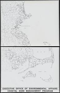
Massachusetts coastal zone management program : volume 1, summary map
12.
Twenty years of change on the Massachusetts coastline : maps and statistics, 1951-1971
13.
Elizabeth Islands : Vineyard Sound the property of James Temple-Bowdoin Esq. : 1836
14.
Eldridge's chart no. 10 : Buzzard's Bay
15.
From Monomoy and Nantucket Shoals to Muskeget Channel, Mass
16.
Eldridge's map of Martha's Vineyard
17.
Map of Cape Cod and vicinity
18.
Map of Cape Cod and vicinity
19.
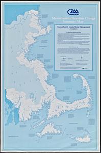
Massachusetts shoreline change summary map
20.
Sketch A showing the progress of the survey in section no. 1 from 1844 to 1881
21.
The 100th anniversary map of Abraham Lincoln's visit to Massachusetts, September 11-23, 1848
22.
Annexation map
23.
Automobile map of Massachusetts : central section
24.
Bicycle map of Massachusetts
25.
Bicycle map of north eastern Massachusetts
26.
Bicycle map of south eastern Massachusetts
27.
Bicycle map of western Massachusetts
28.
Boston and its suburban drives
29.
[Boston and Northwestern Junction Railroad]
30.
Boston and surroundings
31.
Boston and vicinity
32.
Boston and vicinity : 1893
33.
Carte géographique, statistique et historique de Massachusetts
34.
Charles River
35.
Chart of Boston Harbor and Massachusetts Bay : with map of the adjacent country
36.
The city of New York as laid out by the Commissioners with the surrounding country
37.
Colton's Massachusetts and Rhode Island
38.
Cyclists' road map of Massachusetts
39.
G. Woolworth Colton's railroad, township & distance map of New England with adjacent portions of New York, Canada & New Brunswick
40.
Geological map of Massachusetts
41.
Hale's map of the central & western parts of Massachusetts, with a part of New-York
42.
Hammond's new road map of eastern Massachusetts and southern New Hampshire
43.
Hammond's new road map of Rhode Island and southeastern Massachusetts
44.
Hammond's new road map of western Massachusetts
45.
Health crisis : Massachusetts' low income families more likely to live near hazardous sites
46.
Health success : Massachusetts well-prepared to deal with health issues from hazardous sites
47.
Highway map of Plymouth County, Massachusetts : prepared for the Plymouth County atlas
48.
Historic Massachusetts : a travel map to help you feel at home in the Bay State
49.
Hotbeds of contamination : the toxicity of our cities
50.
Index map showing the principal river basins within the state of Massachusetts
‹ Prev
Next ›
1
2
3
4
5
…
164
165


![[Boston and Northwestern Junction Railroad]](https://bpldcassets.blob.core.windows.net/derivatives/images/commonwealth:x059cc74n/image_thumbnail_300.jpg)


