Health crisis : Massachusetts' low income families more likely to live near hazardous sites
Item Information
- Title:
- Health crisis : Massachusetts' low income families more likely to live near hazardous sites
- Cartographer:
- Ollivierre, Alison DeGraff
- Copyright holder:
- Boston Public Library. Norman B. Leventhal Map and Education Center
- Name on Item:
-
cartographer: Alison D. Ollivierre
- Date:
-
2020
- Format:
-
Maps/Atlases
- Location:
-
Boston Public Library
Norman B. Leventhal Map & Education Center - Collection (local):
-
Norman B. Leventhal Map & Education Center Collection
- Subjects:
-
Hazardous waste sites--Massachusetts--Maps
Massachusetts--Maps
Poverty--Massachusetts--Maps
- Places:
-
Massachusetts
- Extent:
- 1 map : color
- Terms of Use:
-
(c) Norman B. Leventhal Map & Education Center at the Boston Public Library
This work is licensed for use under a Creative Commons Attribution License (CC BY).

- Place of origin:
-
[Denver, Colorado]
- Language:
-
English
- Notes:
-
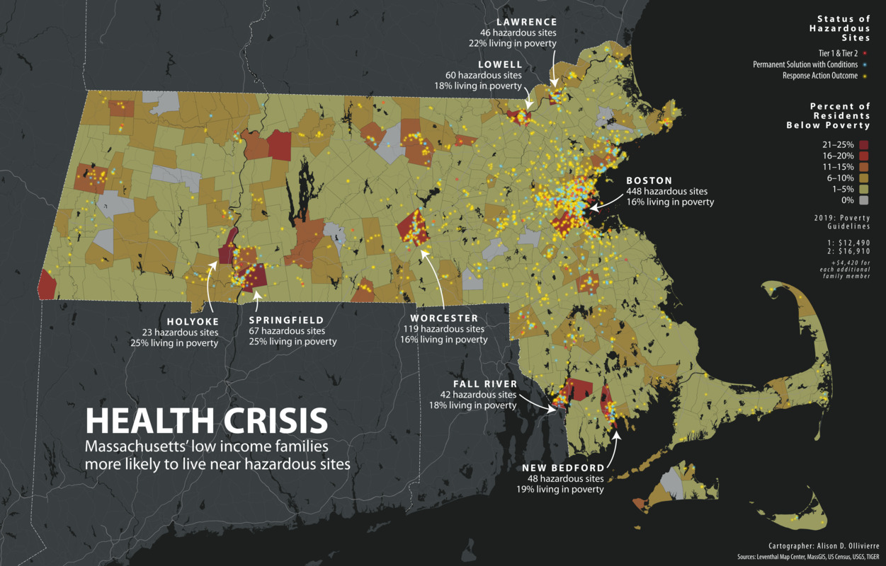
Shows status of hazardous sites and percent of residents below poverty.
"Sources: Leventhal Map Center, MassGIS, US Census, USGS, TIGER."
- Notes (exhibitions):
-
Exhibited: "Bending lines: maps and data from distortion to deception," organized by the Norman B. Leventhal Map & Education Center at the Boston Public Library, 2020-2021.
- Identifier:
-
health_crisis


