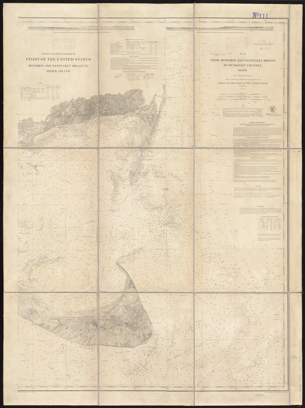
From Monomoy and Nantucket Shoals to Muskeget Channel, Mass
Item Information
- Title:
- From Monomoy and Nantucket Shoals to Muskeget Channel, Mass
- Title (alt.):
-
Monomoy and Nantucket Shoals to Block Island
Coast of the United States Monomoy and Nantucket shoals to Block Island
- Creator:
- U.S. Coast and Geodetic Survey
- Name on Item:
-
from a trigonometrical survey under the direction of A.D. Bache ; redd. drng. by W. M. C. Fairfax and J. Welch ; engd. by A. Sengteller, G. McCoy, W. Phillips and E. A. Maedel.
- Date:
-
1860
- Format:
-
Maps/Atlases
- Location:
-
Boston Public Library
Norman B. Leventhal Map & Education Center - Collection (local):
-
Norman B. Leventhal Map & Education Center Collection
- Subjects:
-
Nautical charts--Massachusetts--Nantucket Sound
Nantucket Sound (Mass.)--Navigation--Maps
- Places:
-
MassachusettsDukes (county)Nantucket Sound (bay)
- Extent:
- 1 map ; 94 x 68 cm.
- Terms of Use:
-
No known copyright restrictions.
No known restrictions on use.
- Publisher:
-
[Washington] :
U.S. Coast and Geodetic Survey
- Scale:
-
Scale 1:80,000
- Language:
-
English
- Notes:
-
Relief shown by hachures and shading.
Depths shown by soundings and shading.
Includes text of sailing directions and dangers, buoys, bottoms, light houses and beacons, light vessels, variations of magnetic needle, tides, and two views.
This chart is also numbered Chart 11, 12, and 13.
- Identifier:
-
06_01_009769
- Call #:
-
G3701.P5 svar .U5 no. 111 1860
- Barcode:
-
39999065709824


