Toggle navigation
LMEC Home
Exhibitions
Georeferencing
Tools for Teachers
Collections
My Favorites
Sign Up / Log In
Search
Search the map portal
Map Collection
Map Collection
Map Sets
Search
Search
Search for
Search In
All Fields
Creator
Title
Subject
Place
Search All Digital Collections
Advanced Search
159 Results
My Search
Start Over
More Like
commonwealth:8s45vn92x
Remove constraint More Like: commonwealth:8s45vn92x
Filter your Search
Place
North and Central America
148
United States
145
Massachusetts
124
Barnstable (county)
20
Middlesex (county)
17
Cape Cod
15
Bristol (county)
9
Plymouth (county)
8
more
Place
»
Topic
Massachusetts--Maps
20
Cape Cod (Mass.)--Maps
16
Martha's Vineyard (Mass.)--Maps
5
Dedham (Mass.)--Maps
4
Election districts--Massachusetts--Maps
4
Land use--Massachusetts--Maps
4
Massachusetts--Administrative and political divisions--Election districts--Maps
4
Massachusetts--Photomaps--Indexes
4
more
Topic
»
Date
Date range begin
–
Date range end
Current results range from
1835
to
2010
View distribution
Creator
Applied Geographics, Inc.
61
MassGIS (Office : Mass.)
56
Massachusetts. Executive Office of Environmental Affairs
32
Geological Survey (U.S.)
9
Massachusetts Bays Program
8
Massachusetts Coastal Zone Management Office
8
National Ocean Survey
6
Massachusetts. Department of Environmental Protection
4
more
Creator
»
Format
Maps/Atlases
158
Ephemera
1
Georeferenced
No
159
Collection
Norman B. Leventhal Map & Education Center Collection
159
Applied Geographics, Inc. Records
143
Boston and New England Maps
129
Urban Maps
28
Maritime Charts and Atlases
17
David Judkins Weaver Papers
2
Available to use
No known restrictions
159
Search Constraints
Sort by relevance
relevance
title
date (asc)
date (desc)
Number of results to display per page
20 per page
10
per page
20
per page
50
per page
100
per page
View results as:
grid view
map view
Search Results
1.
Cape Cod
2.
Cape Cod, Barnstable County, Mass.
3.
Cape Cod open space : SCORP-GIS integration project
4.
Historic Massachusetts : a travel map to help you feel at home in the Bay State
5.
A map of Cape Cod
6.
A map of Cape Cod
7.
A map of Cape Cod
8.
A map of Cape Cod
9.
Map of Cape Cod and vicinity
10.
Map of Cape Cod and vicinity
11.
Map of Cape Cod and vicinity
12.
A map of Cape Cod wherin is shown ye discovery and settlement of the same; with the tracks of ye pilgrims carefully prepared...
13.
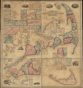
Map of the counties of Barnstable, Dukes and Nantucket, Massachusetts : based upon the trigonometrical survey of the state
14.
A map of the extremity of Cape Cod : including the townships of Provincetown & Truro: with chart of their sea coast and of Cape...
15.
The Pilgrim® map Cape Cod, Martha's Vineyard and Nantucket
16.
The Scrimshaw historical map of Cape Cod
17.
1985 land use in the Mass. Turnpike corridor
18.
Agriculture and wellhead protection in the Connecticut Valley
19.
Appalachian region, as designated by the Appalachian Regional Commission 1967
20.
The Appalachian trail in Massachusetts
‹ Prev
Next ›
1
2
3
4
5
…
7
8