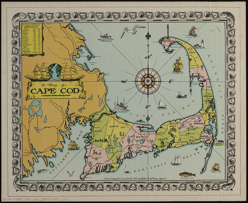
A map of Cape Cod
Item Information
- Title:
- A map of Cape Cod
- Cartographer:
- Gaffney, Walter M.
- Name on Item:
-
drawn, copyrighted, and published 1932 by Walter M. Gaffney
- Date:
-
1932
- Format:
-
Maps/Atlases
- Genre:
-
Pictorial maps
- Location:
-
Boston Public Library
Norman B. Leventhal Map & Education Center - Collection (local):
-
Norman B. Leventhal Map & Education Center Collection
- Subjects:
-
Cape Cod (Mass.)--Maps
- Places:
-
MassachusettsBarnstable (county)Cape Cod (area)
- Extent:
- 1 map : color ; 35 x 46 cm, on sheet 45 x 55 cm
- Terms of Use:
-
No known copyright restrictions.
No known restrictions on use.
- Publisher:
-
Hyannis :
Walter M. Gaffney
- Scale:
-
Scale approximately 1:200,000
- Language:
-
English
- Notes:
-
Includes illustrations, decorative border, and chart showing population of towns in 1930 and 1890.
- Identifier:
-
06_01_019126
- Call #:
-
G3762.C35A5 1932 .G34
- Barcode:
-
39999085971271


