Toggle navigation
LMEC Home
Exhibitions
Georeferencing
Tools for Teachers
Collections
My Favorites
Sign Up / Log In
Search
Search the map portal
Map Collection
Map Collection
Map Sets
Search
Search
Search for
Search In
All Fields
Creator
Title
Subject
Place
Search All Digital Collections
Advanced Search
8705 Results
My Search
Start Over
More Like
commonwealth:4m90f859w
Remove constraint More Like: commonwealth:4m90f859w
Filter your Search
Place
North and Central America
5,936
United States
4,854
Massachusetts
2,079
Europe
1,396
Suffolk (county)
1,046
Boston
1,019
Canada
449
Asia
438
more
Place
»
Topic
Boston (Mass.)--Maps
586
United States--Maps
282
Real property--Massachusetts--Boston--Maps
175
Massachusetts--Maps
162
Landowners--Massachusetts--Boston--Maps
133
North America--Maps--Early works to 1800
103
New England--Maps
102
Europe--Maps
79
more
Topic
»
Date
Date range begin
–
Date range end
Current results range from
1482
to
2023
View distribution
Creator
United States. Hydrographic Office
595
O.H. Bailey & Co
148
Des Barres, Joseph F. W. (Joseph Frederick Wallet), 1722-1824
123
United States. Post Office Dept
120
Ptolemy, 2nd cent
100
Walling, Henry Francis, 1825-1888
94
Geological Survey (U.S.)
86
Jefferys, Thomas, -1771
85
more
Creator
»
Format
Maps/Atlases
8,645
Manuscripts
215
Prints
56
Books
36
Objects/Artifacts
10
Drawings/Illustrations
8
Posters
5
Georeferenced
Yes
869
No
7,836
Collection
Norman B. Leventhal Map & Education Center Collection
8,695
Boston and New England Maps
2,233
Urban Maps
2,023
Maritime Charts and Atlases
1,083
American Revolutionary War-Era Maps
626
Boston Redevelopment Authority Collection
87
William L. Clements Library Collection
9
MacLean Collection Map Library
1
Available to use
No known restrictions
8,553
Creative Commons license
47
Search Constraints
Sort by relevance
relevance
title
date (asc)
date (desc)
Number of results to display per page
20 per page
10
per page
20
per page
50
per page
100
per page
View results as:
grid view
map view
Search Results
21.
State of Ohio coal fields and producing districts
22.
The two routes surveyed for the National Road from Springfield to Richmond, 1835 : reduced from the original survey of Captain...
23.
Action between Genl. St Clairs army & that of the American Indians Novr. 4th 1791 : collected from his public letter
24.
Campaign of Major General Anthony Wayne, 1793-94
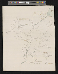
25.
A draft of the Ohio from an Indian account
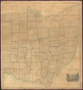
26.
A map of the state of Ohio : from actual survey
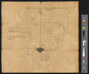
27.
Mr. Mathew's draft of the Scioto & Ohio Companies purchase
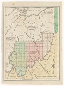
28.
Plan des achats des compagnies de l'Ohio et du Scioto
29.
Plan of St. Clairs battle ground
30.
Plan of the Indian countrys through which the troops marchd in 1764 under the command of Col. Henry Bouquet
31.
A plan of the river Ohio from Fort Pitt to the Mississipi : by order of ye chief engineer
32.
A sketch of the several Indian roads leading from Fort Pitt to Sioto, Lake Erie &c. : takn. from a draft (made on a tour thro'...
33.
A topographical plan of that part of the Indian-country through which the army under the command of Colonel Bouquet marched in...
34.
The 100th anniversary map of Abraham Lincoln's visit to Massachusetts, September 11-23, 1848
35.
1630 shoreline
36.
1879. Progress map of the U.S. Geographical Surveys west of the 100th Meridian : prepared under the direction of 1st Lieut....
37.
1903 Map of Salem and surrounding places
38.
19th annual convention of the National Association of Real Estate Boards : at Tulsa, June 7 to June 11 in 1926
39.
2005 significant U.S. hurricane strikes
40.
The 2100 project : an atlas for the Green New Deal
‹ Prev
Next ›
1
2
3
4
5
6
…
435
436