Toggle navigation
LMEC Home
Exhibitions
Georeferencing
Tools for Teachers
Collections
My Favorites
Sign Up / Log In
Search
Search the map portal
Map Collection
Map Collection
Map Sets
Search
Search
Search for
Search In
All Fields
Creator
Title
Subject
Place
Search All Digital Collections
Advanced Search
51 Results
My Search
Start Over
More Like
commonwealth:cj82m485t
Remove constraint More Like: commonwealth:cj82m485t
Available to use
Creative Commons license
Remove constraint Available to use: Creative Commons license
Filter your Search
Place
North and Central America
40
United States
39
Massachusetts
36
Suffolk (county)
25
Boston
24
South America
6
Asia
3
China
3
more
Place
»
Topic
Boston (Mass.)--Maps
11
Massachusetts--Maps
8
Hazardous waste sites--Massachusetts--Maps
4
South America--Maps--Early works to 1800
4
Immigrants--Massachusetts--Boston--Maps
3
Internet access--Massachusetts--Boston--Maps
3
North America--Maps--Early works to 1800
3
Professions--Massachusetts--Boston--Maps
3
more
Topic
»
Date
Date range begin
–
Date range end
Current results range from
1719
to
2023
1719 : 2024
1719
2024
View distribution
Creator
Boston Public Library. Norman B. Leventhal Map and Education Center
26
Huffman, Daniel P.
9
Woodruff, Andy
6
Hornblower, Belle
4
Jefferys, Thomas, -1771
2
Owens, Margaret
2
Tierney, Lauren C.
2
Wolfe, Julia
2
more
Creator
»
Format
Maps/Atlases
51
Georeferenced
Yes
7
No
44
Collection
Norman B. Leventhal Map & Education Center Collection
48
Boston and New England Maps
34
American Revolutionary War-Era Maps
4
Urban Maps
4
Richard H. Brown Revolutionary War Map Collection at Mount Vernon
3
Mapping Boston Collection
1
Maritime Charts and Atlases
1
Available to use
Creative Commons license
[remove]
51
Search Constraints
Sort by relevance
relevance
title
date (asc)
date (desc)
Number of results to display per page
20 per page
10
per page
20
per page
50
per page
100
per page
View results as:
grid view
map view
Search Results
1.
L'Amerique divisée en septentrionale et méridionale, subdivisée en ses principales parties, dressée sur les relations les...
2.
Carte tres curieuse de la Mer du Sud, contenant des remarques nouvelles et tres utiles non seulement sur les ports et iles de...
3.
Chart of South America, comprehending the West Indies, with the adjacent islands, in the Southern Ocean, and South Sea
4.
LʼAmérique Septentrionale et Méridionale divisée suivant ses différens pays
5.
Archaeological map of Castle Neck and vicinity, Ipswich, Mass. showing ancient Indian villages & remains : made from actual...
6.
Back Bay view of the world
7.
Barton Street, West End
8.
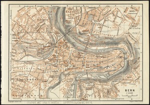
Bern
9.
Boston kids count
10.
Boston's top 5 immigrant populations
11.
Change in median housing value, 2010 to 2018
12.
Change in white population (non-Hispanic), 2010 to 2018
13.
Disconnected : Boston's free wi-fi leaves many in the dark
14.
East Boston flood risk
15.
An exact chart of the river St. Laurence, from Fort Frontenac to the island of Anticosti shewing the soundings, rocks, shoals...
16.
The facts of prohibition in the United States
17.
Fairbanks Street, Brighton
18.
Great circle airways
19.
The great transit desert
20.
Health crisis : Massachusetts' low income families more likely to live near hazardous sites
‹ Prev
Next ›
1
2
3